Skip to search
Skip to main content
Skip to first result
Digital Commonwealth
Folders
Sign Up / Log In
Search for
Search
Search
Search
Basic
Advanced
Explore
Map
Collections
Institutions
Formats
For Educators
Primary Source Sets
Lesson Plans
Using Primary Sources
Searching Digital Commonwealth
For Institutions
Join Digital Commonwealth
Conferences, Trainings, & Events
How to Contribute Collections
Digitization Services
Board & Committees
Frequently Asked Questions
About
About Digital Commonwealth
News & Announcements
Copyright & Terms of Use
Harmful Content Statement
Partners
API
Contact Us
Search
Search Constraints
Start Over
Save Search
Your search:
More Like
commonwealth:x633fb29b
✖
Remove constraint More Like: commonwealth:x633fb29b
« Prev.
|
21
-
40
of
207
|
Next »
Sort
by relevance
relevance
title
date (asc)
date (desc)
Number of results to display per page
20
per page
per page
10
per page
20
per page
50
per page
100
per page
View results as:
List
list view
Maps
map view
Gallery
grid view
Search Results
21.
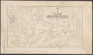
Boston Bay and approaches
22.
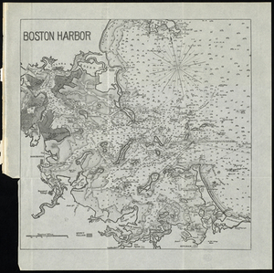
Boston Harbour
23.
Map of parts of Boston Harbor and its tributaries
24.
Map to accompany report of State Board on Docks and Terminal Facilities : showing existing conditions and proposed changes at...
25.
A new survey of the harbour of Boston in New England : done by order of the principall officers and comissioners of Her Maties....
26.
Plan of Boston
27.
Plan of Boston
28.
Boston Bay
29.
Massachusetts Bay with the coast from Cape Ann to Cape Cod
30.
Boston Bay and Harbor
31.
Boston Harbor
32.
Boston Harbor
33.
Boston Harbor
34.
Boston Harbor & vicinity
35.
Boston Harbor Mass : Charles River from Brookline Street bridge to Market Street bridge
36.
Boston Harbor, Mass : map of Charles River from Brookline Street bridge to its mouth
37.
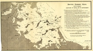
Boston Harbor, Mass.: Sketch Showing Locations of Works For Its Improvement.
38.
Boston Harbor, Massachusetts
39.
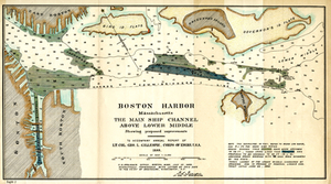
Boston Harbor, Massachusetts: The Main Ship Channel Above Lower Middle
40.
Boston Inner Harbor Massachusetts
« Previous
Next »
1
2
3
4
5
6
…
10
11
Limit your search
Subject
Boston Harbor (Mass.)--Maps
73
Boston (Mass.)--Maps
36
New England--Maps--Early works to 1800
23
World maps--Early works to 1800
19
Harbors--Massachusetts--Boston--Maps
18
Nautical charts--Massachusetts--Boston Harbor
17
Boston (Mass.)--History--Revolution, 1775-1783--Maps--Early works to 1800
16
Boston Harbor (Mass.)--Maps--Early works to 1800
13
more
Subject
»
Place
North and Central America
173
United States
146
Boston Harbor
77
Boston
74
Suffolk (county)
74
Massachusetts
30
New England
30
World
19
more
Place
»
Format
Maps/Atlases
206
Posters
1
Prints
1
Available to use
Creative Commons license
137
No known restrictions
52
Date
View distribution
Current results range from
1493
to
1985
Date range begin
Date range end
View larger »
Unknown
1
Collection
Norman B. Leventhal Map Center Collection
187
Mapping Boston Collection
139
Boston and New England Maps (Collection of Distinction)
117
American Revolutionary War-Era Maps (Collection of Distinction)
35
Maritime Charts and Atlases (Collection of Distinction)
35
Urban Maps (Collection of Distinction)
27
Historic Maps
9
Massachusetts Board of Harbor and Land Commissioners
8
more
Collection
»
Institution
Private Collection
139
Boston Public Library
50
Salem State University Archives and Special Collections
9
State Library of Massachusetts
8
American Antiquarian Society
1