Skip to search
Skip to main content
Skip to first result
Digital Commonwealth
Folders
Sign Up / Log In
Search for
Search
Search
Search
Basic
Advanced
Explore
Map
Collections
Institutions
Formats
For Educators
Primary Source Sets
Lesson Plans
Using Primary Sources
Searching Digital Commonwealth
For Institutions
Join Digital Commonwealth
Conferences, Trainings, & Events
How to Contribute Collections
Digitization Services
Board & Committees
Frequently Asked Questions
About
About Digital Commonwealth
News & Announcements
Copyright & Terms of Use
Harmful Content Statement
Partners
API
Contact Us
Search
Search Constraints
Start Over
Save Search
Your search:
More Like
commonwealth:x059cd818
✖
Remove constraint More Like: commonwealth:x059cd818
« Prev.
|
10,701
-
10,800
of
11,006
|
Next »
Sort
by date (asc)
relevance
title
date (asc)
date (desc)
Number of results to display per page
100
per page
per page
10
per page
20
per page
50
per page
100
per page
View results as:
List
list view
Maps
map view
Gallery
grid view
Search Results
10701.
The pictorial map, stamps of America
10702.
The pictorial map, stamps of the U.S.A.
10703.
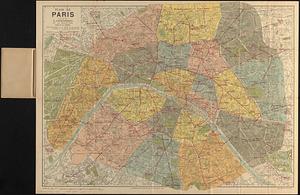
Plan de Paris divisé en 20 arrondissements et 80 quartiers
10704.
The 100th anniversary map of Abraham Lincoln's visit to Massachusetts, September 11-23, 1848
10705.
Ask Shell!
10706.
The Boston Globe ski map of northern New England and Canada
10707.
Election map of the United States with 49 novel diagrams
10708.
Map of the island of Tangerina and Wild Island
10709.
Metropolitan Transit Authority system route map
10710.
Atlas of town of Weymouth Massachusetts
10711.
Gay days around America : a pleasure map of festivals, pageants, and special events best reached by Greyhound ... the...
10712.
A map of the West Indies and the Spanish Main
10713.
The pictorial map, United States stamps
10714.
Storrow Memorial Embankment : plan of additions and changes under the requirements of Chapter 262, Acts of 1949
10715.
A Texan's map of the United States [of Texas]
10716.
These United States : products & industries
10717.
United States inlay puzzle
10718.
Armour food source map
10719.
The Chevron trail through the scenic west
10720.
Illustrierte karte der Vereinigten Staaten von Amerika : mit darstellung der regionalen bodenschätze, produkte und...
10721.
Maps from General plan for Boston : preliminary report, December, 1950
10722.
Metropolitan Transit Authority system route map
10723.
A Scott-Map of Boston, Massachusetts
10724.
World freedom : a factual & pictorial map
10725.
Eastern Mediterranean
10726.
A pictorial stamp map of navigation and exploration
10727.
Portugal is not a small country
10728.
USAF cloth chart, Western Mediterranean
10729.
Map of the Boston Metropolitan District showing park reservations and holdings of the Metropolitan District Commission and...
10730.
Maps with a moral
10731.
Metropolitan Transit Authority system route map
10732.
Pashtunistan
10733.
Metropolitan Transit Authority system route map
10734.
Town of Belmont Massachusetts
10735.
The town of Dedham, Massachusetts : a pictorial map
10736.
United States, including territories and insular possessions : showing the extent of public surveys, national parks, national...
10737.
Ward lines and voting precincts 1954
10738.
A two-way street between the Americas
10739.
Atlas of town of Weymouth Massachusetts
10740.
Dublin
10741.
Makers of the U.S.A. : a friendship map
10742.
Metropolitan Transit Authority system route map
10743.
Oil in America : a pictorial story of the petroleum industry in the United States
10744.
Sportsmen's fishing map of the United States and neighboring waters
10745.
Cape Cod and the islands
10746.
The United States, the land and the people = Les états-Unis, le pays et ses habitants = De Verenigde Staten, het land en het volk
10747.
Daily weather map : Tuesday, September 29, 1959
10748.
Metropolitan Transit Authority system route map
10749.
A nation of immigrants
10750.
Panoramic view of Boston showing golden semicircle
10751.
Ward boundaries 1959
10752.
Wards & precincts, city of Boston - 1890
10753.
City of Boston topographic and planimetric survey : [Downtown and North End]
10754.
Civil War centennial
10755.
Navajoland, U.S.A.
10756.
Dominican Republic road map 1:250,000
10757.
Historic Massachusetts : a travel map to help you feel at home in the Bay State
10758.
Metropolitan Transit Authority system route map
10759.
City of Boston : topographic and planimetric survey
10760.
Route chart showing routes to and from northwestern Europe
10761.
Zoning districts, city of Boston
10762.
Map of Ho-De-No-Sau-Nee-Ga or the people of the long house : compiled 1851 by Lewis H. Morgan & Ely S. Parker a Seneca sachem...
10763.
A map of the state of Maine
10764.
Sketches of a building to be constructed in City Hall Plaza north of Boston City Hall
10765.
Historic Massachusetts : a travel map to help you feel at home in the Bay State
10766.
Metropolitan Transit Authority system route map
10767.
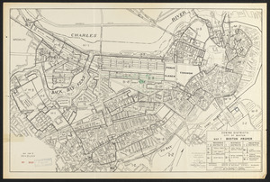
Boston proper
10768.
Massachusetts Bay Transportation Authority system route map
10769.
Boston personal income ; Boston personal income [and] residential population density
10770.
Massachusetts Bay Transportation Authority system route map
10771.
Panorama from the Pinnacle ("Acorn Hill," 1371'), Lyme, N.H.
10772.
The Scrimshaw historical map of Cape Cod
10773.
Zoning districts, city of Boston : Map I Boston proper
10774.
Atlas of the town of Wayland
10775.
Massachusetts Bay Transportation Authority
10776.
Yuenan renmin kang mei jiu guo xing shi tu
10777.
Charlestown urban renewal project Boston (Suffolk County) Massachusetts Mass. R-55 : topographic map
10778.
Illustrative site plan : Government Center urban renewal area, Massachusetts R-35
10779.
Off-street parking inventory for the Boston regional core
10780.
One way streets, metered block faces, parking restriction areas and signal locations within the Boston regional core
10781.
Atlas of the town of Brookline 1969
10782.
Boston development program
10783.
West Canton Community Park
10784.
Boylston Street improvements
10785.
Illustration of the south side of Boylston Street between Clarendon and Berkeley Streets
10786.
Illustrative site plan : Washington Park urban renewal area, Massachusetts R-24
10787.
Plans of structures next to the end towers of Longfellow Bridge
10788.
Washington Street corridor : South Cove to Forest Hills
10789.
Campus High School urban renewal area Mass. r-129 : property map
10790.
Kingston-Port-au-Prince
10791.
Atlas of the town of Brookline 1972
10792.
Baton Rouge
10793.
Morrisville, Bucks County, Pennsylvania, 1893
10794.
Breton Sound
10795.
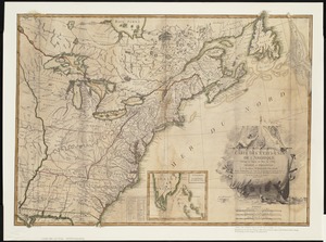
Carte des Etats-Unis de l'Amerique suivant le Traité de Paix de 1783 : dédiée et présentée a S. Excellence Mr. Benjamin...
10796.
Italy
10797.
Library districts [in Boston]
10798.
Off-street parking inventory within Boston proper
10799.
Metropolitan Boston transportation map : subway, bus, rail
10800.
Charlestown urban renewal area project no. Mass. R-55 Boston - Suffolk County - Massachusetts delivery parcel plan : parcel...
« Previous
Next »
1
2
…
104
105
106
107
108
109
110
111
Limit your search
Subject
Real property--Massachusetts--Boston--Maps
2,278
Landowners--Massachusetts--Boston--Maps
2,117
Boston (Mass.)--Maps
1,966
Roxbury (Boston, Mass.)--Maps
351
Dorchester (Boston, Mass.)--Maps
317
Cambridge (Mass.)--Maps
266
Brookline (Mass.)--Maps
236
Real property--Massachusetts--Cambridge--Maps
216
more
Subject
»
Place
North and Central America
7,815
United States
6,434
Suffolk (county)
3,338
Boston
3,198
Massachusetts
3,167
Europe
963
Middlesex (county)
617
Canada
427
more
Place
»
Format
Maps/Atlases
10,946
Manuscripts
215
Prints
51
Books
35
Objects/Artifacts
10
Drawings/Illustrations
8
Posters
4
Photographs
1
Available to use
No known restrictions
10,933
Creative Commons license
46
Date
View distribution
Current results range from
1482
to
2023
Date range begin
Date range end
View larger »
Collection
Norman B. Leventhal Map Center Collection
11,003
Boston and New England Maps (Collection of Distinction)
5,106
Urban Maps (Collection of Distinction)
4,846
Maritime Charts and Atlases (Collection of Distinction)
750
American Revolutionary War-Era Maps (Collection of Distinction)
615
Boston Redevelopment Authority Collection
86
Sidney R. Knafel Map Collection at Phillips Academy
2
Chinese Progressive Association Records
1
Institution
Boston Public Library
11,003
Phillips Academy
2
Northeastern University Library
1


![A Texan's map of the United States [of Texas]](https://bpldcassets.blob.core.windows.net/derivatives/images/commonwealth:fn107c388/image_thumbnail_300.jpg)


![Boston personal income ; Boston personal income [and] residential population density](https://bpldcassets.blob.core.windows.net/derivatives/images/commonwealth:fn107c409/image_thumbnail_300.jpg)


![Library districts [in Boston]](https://bpldcassets.blob.core.windows.net/derivatives/images/commonwealth:3f465b625/image_thumbnail_300.jpg)


