Skip to search
Skip to main content
Skip to first result
Digital Commonwealth
Folders
Sign Up / Log In
Search for
Search
Search
Search
Basic
Advanced
Explore
Map
Collections
Institutions
Formats
For Educators
Primary Source Sets
Lesson Plans
Using Primary Sources
Searching Digital Commonwealth
For Institutions
Join Digital Commonwealth
Conferences, Trainings, & Events
How to Contribute Collections
Digitization Services
Board & Committees
Frequently Asked Questions
About
About Digital Commonwealth
News & Announcements
Copyright & Terms of Use
Harmful Content Statement
Partners
API
Contact Us
Search
Search Constraints
Start Over
Save Search
Your search:
More Like
commonwealth:wd376676m
✖
Remove constraint More Like: commonwealth:wd376676m
« Prev.
|
9,781
-
9,800
of
11,138
|
Next »
Sort
by relevance
relevance
title
date (asc)
date (desc)
Number of results to display per page
20
per page
per page
10
per page
20
per page
50
per page
100
per page
View results as:
List
list view
Maps
map view
Gallery
grid view
Search Results
9781.
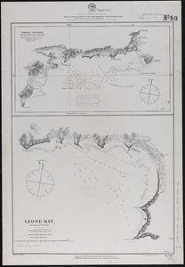
Samoan Group--Tutuila Id.
9782.
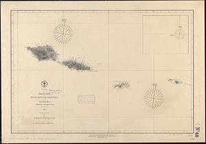
Samoan or Navigator Islands
9783.
Samuel Thaxter & Son, manufacturers and importers of nautical and optical instruments, charts and nautical books; publishers of...
9784.
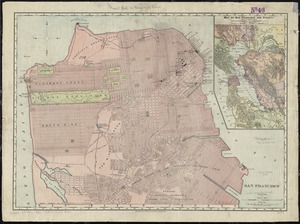
San Francisco
9785.
Sandwich Bay ... low water
9786.
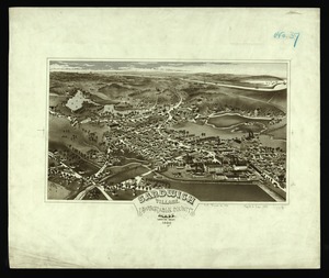
Sandwich Village, Barnstable County, Mass., looking west
9787.
Sandy-Bay, Mass
9788.
Sanford, Maine : looking east
9789.
Santiam National Forest, Oregon
9790.
Saratoga Springs and vicinity : scene of the inter-collegiate regatta : [see page 626]
9791.
Saskatchewan : map showing disposition of lands
9792.
Saskatchewan
9793.
Saskatchewan : map showing disposition of lands
9794.
Satsuma, Putnam County, Florida : the property of Whitney, Gold and Hodges
9795.
Sauk County, Wis.
9796.
Sault du Niagara de 135 pieds de haut
9797.
[Scandinavia]
9798.
Scarborough's map of Ontario : with an index of all cities, villages, post-offices and railway stations and population...
9799.
Scarborough's new county and post office map of Louisiana and Mississippi : with complete index giving population and location...
9800.
Scarborough's new county and post office map of Virginia, Maryland, Delaware, and District of Columbia : with complete index...
« Previous
Next »
1
2
…
486
487
488
489
490
491
492
493
494
…
556
557
Limit your search
Subject
Real property--Massachusetts--Boston--Maps
2,278
Landowners--Massachusetts--Boston--Maps
2,117
Boston (Mass.)--Maps
1,980
Roxbury (Boston, Mass.)--Maps
351
Dorchester (Boston, Mass.)--Maps
317
Massachusetts--Maps
271
Cambridge (Mass.)--Maps
266
Brookline (Mass.)--Maps
236
more
Subject
»
Place
North and Central America
7,952
United States
6,552
Suffolk (county)
3,364
Massachusetts
3,290
Boston
3,224
Europe
963
Middlesex (county)
617
Canada
428
more
Place
»
Format
Maps/Atlases
11,078
Manuscripts
217
Prints
51
Books
36
Objects/Artifacts
10
Drawings/Illustrations
8
Posters
5
Available to use
No known restrictions
10,963
Creative Commons license
60
Date
View distribution
Current results range from
1482
to
2023
Date range begin
Date range end
View larger »
Unknown
2
Collection
Norman B. Leventhal Map Center Collection
11,039
Boston and New England Maps (Collection of Distinction)
5,150
Urban Maps (Collection of Distinction)
4,851
Maritime Charts and Atlases (Collection of Distinction)
754
American Revolutionary War-Era Maps (Collection of Distinction)
623
Boston Redevelopment Authority Collection
91
Historic Maps
41
David Judkins Weaver Papers
18
more
Collection
»
Institution
Boston Public Library
11,031
Salem State University Archives and Special Collections
41
State Library of Massachusetts
38
Private Collection
13
Phillips Academy
8
American Antiquarian Society
5
Massachusetts Historical Society
1
Melrose Public Library
1


![[Scandinavia]](https://bpldcassets.blob.core.windows.net/derivatives/images/commonwealth:7h14b059b/image_thumbnail_300.jpg)


