Skip to search
Skip to main content
Skip to first result
Digital Commonwealth
Folders
Sign Up / Log In
Search for
Search
Search
Search
Basic
Advanced
Explore
Map
Collections
Institutions
Formats
For Educators
Primary Source Sets
Lesson Plans
Using Primary Sources
Searching Digital Commonwealth
For Institutions
Join Digital Commonwealth
Conferences, Trainings, & Events
How to Contribute Collections
Digitization Services
Board & Committees
Frequently Asked Questions
About
About Digital Commonwealth
News & Announcements
Copyright & Terms of Use
Harmful Content Statement
Partners
API
Contact Us
Search
Search Constraints
Start Over
Save Search
Your search:
More Like
commonwealth:tt44pw01j
✖
Remove constraint More Like: commonwealth:tt44pw01j
« Prev.
|
10,941
-
10,960
of
11,273
|
Next »
Sort
by relevance
relevance
title
date (asc)
date (desc)
Number of results to display per page
20
per page
per page
10
per page
20
per page
50
per page
100
per page
View results as:
List
list view
Maps
map view
Gallery
grid view
Search Results
10941.
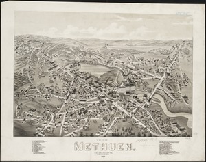
View of Methuen, Massachusetts : 1882
10942.
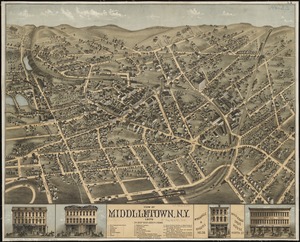
View of Middletown, N.Y : 1874
10943.
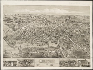
View of Milford, Conn : 1882
10944.
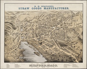
View of Milford, Mass : 1876
10945.
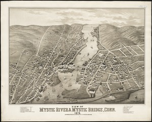
View of Mystic River & Mystic Bridge, Conn. 1879
10946.
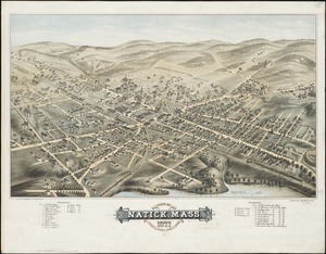
View of Natick, Mass : 1877, population about 8000
10947.
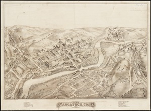
View of Naugatuck, Conn : 1877
10948.
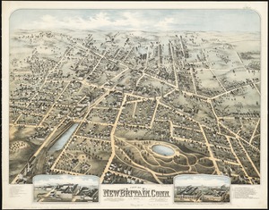
View of New Britain, Conn : 1875
10949.
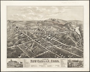
View of New Canaan, Conn : 1878
10950.
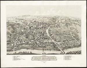
View of New Milford, Conn : 1882
10951.
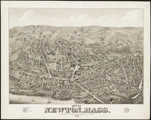
View of Newton, Mass : comprising Wards 1 & 7 & environs of the city of Newton
10952.
View of North Easton, Massachusetts, 1881
10953.
View of North Manchester, Connecticut : 1880
10954.
View of Northborough, Massachusetts : 1887
10955.
View of Oneida, N.Y : 1874
10956.
View of Palmer, Mass
10957.
A view of part of the town of Boston in New-England and Brittish [sic] ships of war landing their troops! 1768
10958.
View of Peabody, Mass : 1877
10959.
A view of Port Hood, sailing into the harbor : A view of the Plaister Cliffs, in George's Bay
10960.
A view of Portsmouth in Piscataqua River
« Previous
Next »
1
2
…
544
545
546
547
548
549
550
551
552
…
563
564
Limit your search
Subject
Real property--Massachusetts--Boston--Maps
2,355
Boston (Mass.)--Maps
2,181
Landowners--Massachusetts--Boston--Maps
2,153
Roxbury (Boston, Mass.)--Maps
363
Dorchester (Boston, Mass.)--Maps
325
Cambridge (Mass.)--Maps
268
Brookline (Mass.)--Maps
237
Real property--Massachusetts--Cambridge--Maps
216
more
Subject
»
Place
North and Central America
8,087
United States
6,704
Suffolk (county)
3,606
Boston
3,466
Massachusetts
3,250
Europe
963
Middlesex (county)
619
Canada
427
more
Place
»
Format
Maps/Atlases
11,214
Manuscripts
215
Prints
51
Books
35
Objects/Artifacts
10
Drawings/Illustrations
8
Posters
4
Available to use
No known restrictions
11,075
Creative Commons license
67
Date
View distribution
Current results range from
1482
to
2023
Date range begin
Date range end
View larger »
Unknown
3
Collection
Norman B. Leventhal Map Center Collection
11,028
Boston and New England Maps (Collection of Distinction)
5,260
Urban Maps (Collection of Distinction)
4,996
Maritime Charts and Atlases (Collection of Distinction)
750
American Revolutionary War-Era Maps (Collection of Distinction)
625
Boston Redevelopment Authority Collection
222
Historic Maps
49
Massachusetts Real Estate Atlases
38
more
Collection
»
Institution
Boston Public Library
11,143
State Library of Massachusetts
51
Salem State University Archives and Special Collections
49
Private Collection
20
American Antiquarian Society
9
Boston Athenaeum
1


![A view of part of the town of Boston in New-England and Brittish [sic] ships of war landing their troops! 1768](https://bpldcassets.blob.core.windows.net/derivatives/images/commonwealth:4m90f851p/image_thumbnail_300.jpg)


