Skip to search
Skip to main content
Skip to first result
Digital Commonwealth
Folders
Sign Up / Log In
Search for
Search
Search
Search
Basic
Advanced
Explore
Map
Collections
Institutions
Formats
For Educators
Primary Source Sets
Lesson Plans
Using Primary Sources
Searching Digital Commonwealth
For Institutions
Join Digital Commonwealth
Conferences, Trainings, & Events
How to Contribute Collections
Digitization Services
Board & Committees
Frequently Asked Questions
About
About Digital Commonwealth
News & Announcements
Copyright & Terms of Use
Harmful Content Statement
Partners
API
Contact Us
Search
Search Constraints
Start Over
Save Search
Your search:
More Like
commonwealth:qv33t176v
✖
Remove constraint More Like: commonwealth:qv33t176v
« Prev.
|
641
-
652
of
652
| Next »
Sort
by relevance
relevance
title
date (asc)
date (desc)
Number of results to display per page
20
per page
per page
10
per page
20
per page
50
per page
100
per page
View results as:
List
list view
Maps
map view
Gallery
grid view
Search Results
641.
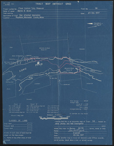
Tract Map (Without Grid) Flood Control - Tully Reservoir
642.
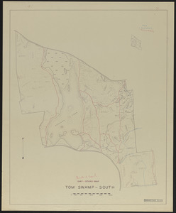
Trail mowing operations, roads and trails Tom Swamp South
643.
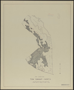
Trail mowing operations, Tom Swamp North
644.
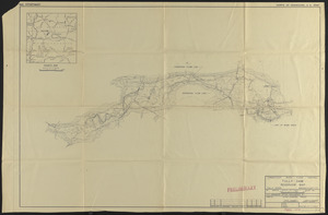
Tully Dam Reservoir Map
645.
Type and height or age map of TS II-VI
646.
Type and operations maps of the Adams-Fay Lot (TS IX)
647.
Type and reproduction cutting map of TS IX 1934
648.
Type Map of Slab City Tract Compartments III - VIII
649.
Upham Lot Harvard Forest
650.
The Waldo Tract Tom Swamp X 1971
651.
Wilder Lot Petersham
652.
Wilder Lot Petersham
« Previous
Next »
1
2
…
29
30
31
32
33
Limit your search
Subject
Boundaries
151
Forest operations
47
1937
44
1938
41
Hurricanes
37
Land use
37
1946
31
Forest Operations
27
more
Subject
»
Place
North and Central America
647
United States
647
Massachusetts
623
Worcester (county)
596
Petersham
587
Tom Swamp
158
Prospect Hill
152
Tom Swamp Tract
97
more
Place
»
Format
Maps/Atlases
646
Audio recordings (nonmusical)
5
Manuscripts
4
Photographs
1
Available to use
Creative Commons license
647
Date
View distribution
Current results range from
1755
to
2016
Date range begin
Date range end
View larger »
Collection
The Harvard Forest Map Collection
647
American Archive of Public Broadcasting Collection
5
Institution
Harvard University
647
Illinois Public Media (WILL)
5