Skip to search
Skip to main content
Skip to first result
Digital Commonwealth
Folders
Sign Up / Log In
Search for
Search
Search
Search
Basic
Advanced
Explore
Map
Collections
Institutions
Formats
For Educators
Primary Source Sets
Lesson Plans
Using Primary Sources
Searching Digital Commonwealth
For Institutions
Join Digital Commonwealth
Conferences, Trainings, & Events
How to Contribute Collections
Digitization Services
Board & Committees
Frequently Asked Questions
About
About Digital Commonwealth
News & Announcements
Copyright & Terms of Use
Harmful Content Statement
Partners
API
Contact Us
Search
Search Constraints
Start Over
Save Search
Your search:
More Like
commonwealth:n8710649r
✖
Remove constraint More Like: commonwealth:n8710649r
« Prev.
|
141
-
160
of
167
|
Next »
Sort
by relevance
relevance
title
date (asc)
date (desc)
Number of results to display per page
20
per page
per page
10
per page
20
per page
50
per page
100
per page
View results as:
List
list view
Maps
map view
Gallery
grid view
Search Results
141.
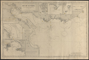
Rio de la Plata
142.
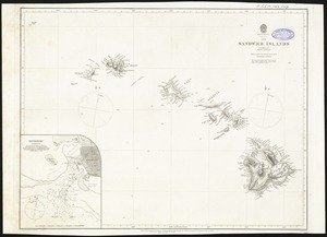
The Sandwich Islands, from various but imperfect authorities
143.
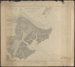
Savannah River and Wassaw Sound
144.
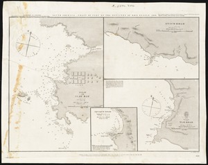
South America, coast of Peru
145.
South and east coasts of Australia, chart no. 1, Australian Bight to Cape Northumberland
146.
South Atlantic
147.
South Norwalk, Sheffield Id. and Cockenoe Id. Harbors, Conn.
148.
South Pacific
149.
St. Helena Sound, South Carolina
150.
Stamford, Conn.
151.
Straat Madura. Eild. Java no. 5. Zuider Breedle
152.
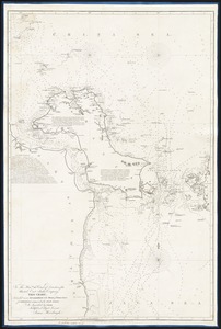
The Straits of Malacca and Singapore compiled from the most recent surveys
153.
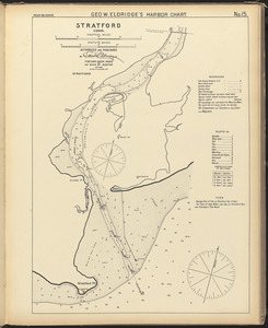
Stratford, Conn.
154.
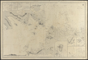
Sunda Strait and its approaches
155.
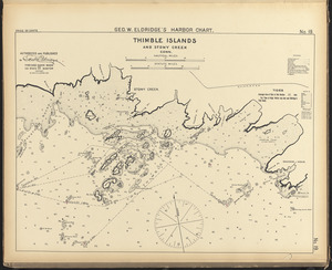
Thimble Islands and Stony Creek, Conn.
156.
This chart, intended as an accompaniment to the book of directions for navigating to, from, and in the East Indies
157.
Vaarwaters van Soerabaja
158.
Vineyard Haven and Cottage City, Mass.
159.
Wareham River, Mass.
160.
Warren, R.I.
« Previous
Next »
1
2
…
4
5
6
7
8
9
Limit your search
Subject
Harbors
52
Coastlines
27
Bays (Bodies of water)
23
Oceans
11
Rivers
10
Channels
9
Islands
8
Seas
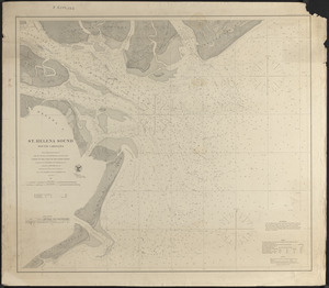
4
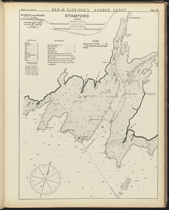
more
Subject
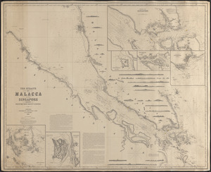
»
Place
North and Central America
99
United States
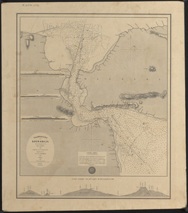
91
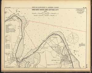
Massachusetts
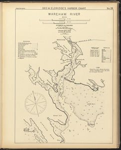
30
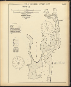
Connecticut
17
Asia
11
Dukes (county)
10
Rhode Island
10
Barnstable (county)
9
more
Place
»
Format
Maps/Atlases
167
Available to use
Creative Commons license
167
Date
View distribution
Current results range from
1821
to
1919
Date range begin
Date range end
View larger »
Collection
Nautical Chart Collection of the Chatham Historical Society
167
Institution
Atwood Museum of the Chatham Historical Society
167