Skip to search
Skip to main content
Skip to first result
Digital Commonwealth
Folders
Sign Up / Log In
Search for
Search
Search
Search
Basic
Advanced
Explore
Map
Collections
Institutions
Formats
For Educators
Primary Source Sets
Lesson Plans
Using Primary Sources
Searching Digital Commonwealth
For Institutions
Join Digital Commonwealth
Conferences, Trainings, & Events
How to Contribute Collections
Digitization Services
Board & Committees
Frequently Asked Questions
About
About Digital Commonwealth
News & Announcements
Copyright & Terms of Use
Harmful Content Statement
Partners
API
Contact Us
Search
Search Constraints
Start Over
Save Search
Your search:
More Like
commonwealth:n8710649r
✖
Remove constraint More Like: commonwealth:n8710649r
« Prev.
|
41
-
60
of
167
|
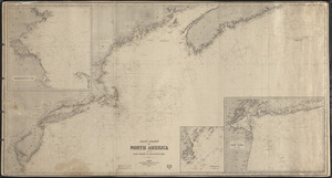
Next »
Sort
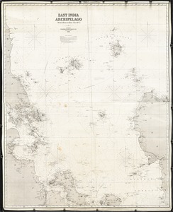
by relevance
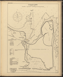
relevance
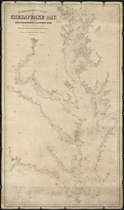
title
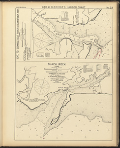
date (asc)
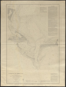
date (desc)
Number of results to display per page
20
per page
per page
10
per page
20
per page
50
per page
100
per page
View results as:
List
list view
Maps
map view
Gallery
grid view
Search Results
41.
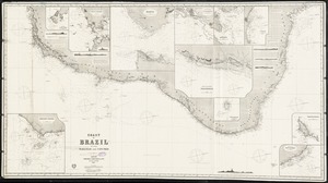
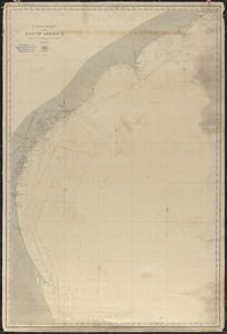
Coast of Brazil, between Maranhao and Cape Frio
42.
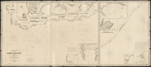
The Coast of the Cape Colony
43.
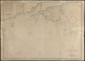
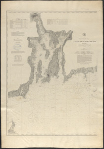
Coast of the United States from New York to Cape Ann
44.
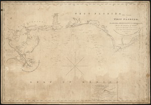
The coasts of West Florida, Alabama, Mississippi & Louisiana; from the surveys of Gauld improved by those of the U.S....
45.
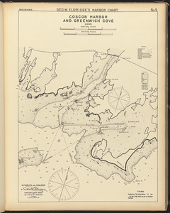
Coscob Harbor and Greenwich Cove, Conn.
46.
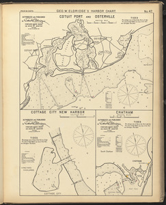
Cotuit Port and Osterville ; Cottage City New Harbor ; Chatham
47.
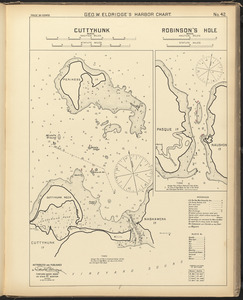
Cuttyhunk, Mass. ; Robinson's Hole, Mass.
48.
Cuttyhunk to Block Island including Narragansett Bay
49.
Cuttyhunk to Block Island including Narragansett Bay
50.
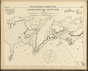
Darien River and Scotts Cove, Conn.
51.
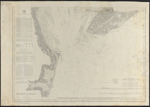
Delaware Entrance
52.
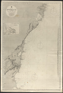
East coast of Australia, New South Wales, Beecroft Head to Port Jackson
53.
East coast of Australia, New South Wales, Port Jackson to Port Stephens
54.
East coast of North America
55.
East coast of North America from Cape Canso to Delaware Bay
56.
East India Archipelago (West route to China. Chart No. 2)
57.
Edgartown
58.
Eldridge's chart of Chesapeake Bay, with the James, York, Rappahannock and Potomas Rivers
59.
Ent. to Connecticut River or Saybrook Hbr., Conn. ; Black Rock, Conn.
60.
Entrance to Mobile Bay
« Previous
Next »
1
2
3
4
5
6
7
8
9
Limit your search
Subject
Harbors
52
Coastlines
27
Bays (Bodies of water)
23
Oceans
11
Rivers
10
Channels
9
Islands
8
Seas
4
more
Subject
»
Place
North and Central America
99
United States
91
Massachusetts
30
Connecticut
17
Asia
11
Dukes (county)
10
Rhode Island
10
Barnstable (county)
9
more
Place
»
Format
Maps/Atlases
167
Available to use
Creative Commons license
167
Date
View distribution
Current results range from
1821
to
1919
Date range begin
Date range end
View larger »
Collection
Nautical Chart Collection of the Chatham Historical Society
167
Institution
Atwood Museum of the Chatham Historical Society
167