Skip to search
Skip to main content
Skip to first result
Digital Commonwealth
Folders
Sign Up / Log In
Search for
Search
Search
Search
Basic
Advanced
Explore
Map
Collections
Institutions
Formats
For Educators
Primary Source Sets
Lesson Plans
Using Primary Sources
Searching Digital Commonwealth
For Institutions
Join Digital Commonwealth
Conferences, Trainings, & Events
How to Contribute Collections
Digitization Services
Board & Committees
Frequently Asked Questions
About
About Digital Commonwealth
News & Announcements
Copyright & Terms of Use
Harmful Content Statement
Partners
API
Contact Us
Search
Search Constraints
Start Over
Save Search
Your search:
More Like
commonwealth:ht250326t
✖
Remove constraint More Like: commonwealth:ht250326t
« Prev.
|
51
-
100
of
11,010
|
Next »
Sort
by date (desc)
relevance
title
date (asc)
date (desc)
Number of results to display per page
50
per page
per page
10
per page
20
per page
50
per page
100
per page
View results as:
List
list view
Maps
map view
Gallery
grid view
Search Results
51.
Boston's top foreign-born populations : Haitians
52.
Boston's top foreign-born populations : Dominicans
53.
Boston's top foreign-born populations : Salvadorans
54.
Boston's top foreign-born populations : Chinese
55.
Boston's top foreign-born populations : Vietnamese
56.
Map of the countries near to the land of Oz
57.
A South Ender's view of the world
58.
Massachusetts official transportation map
59.
Neighborhoods of Boston
60.
1630 shoreline
61.
Nantucket
62.
Boston Over Time : filling in the land 1630 - present
63.
The people's republic of Cambridge
64.
State of Louisiana, highlighting low-lying areas derived from USGS digital elevation data
65.
Peters World map
66.
2005 significant U.S. hurricane strikes
67.
Africa
68.
Massachusetts Turnpike map : the main street of Massachusetts
69.
The population map
70.
South America
71.
The world turned upside down
72.
Asia
73.
Iraq
74.
Massachusetts official transportation map
75.
What's up? South! : world map
76.
China
77.
China
78.
Physical map of the world, April 2001
79.
Political map of the world, April 2001
80.
Area plan as of May 1962
81.
The Boston Public Libraries
82.
The public libraries of Massachusetts
83.
Sudan
84.
Boston shoreline 1630
85.
Boston shoreline 1795
86.
Boston shoreline 1852
87.
Boston shoreline 1880
88.
Boston shoreline 1916
89.
Boston shoreline 1934
90.
Boston shoreline 1950
91.
Boston shoreline 1995
92.
Boston shoreline composite
93.
Tactical pilotage chart, TPC
94.
Mediterranean Sea, plans on the coasts of Italy and Sicilia
95.
Haiti
96.
Major thoroughfare system, city of Boston, July, 1994
97.
North Atlantic Ocean, southeast coast of North America, including the Bahamas and Greater Antilles
98.
East Asia
99.
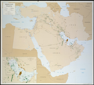
Middle East, oil and gas : Middle East
100.
North Atlantic Ocean, West Indies
« Previous
Next »
1
2
3
4
5
6
…
220
221
Limit your search
Subject
Real property--Massachusetts--Boston--Maps
2,278
Landowners--Massachusetts--Boston--Maps
2,117
Boston (Mass.)--Maps
1,967
Roxbury (Boston, Mass.)--Maps
351
Dorchester (Boston, Mass.)--Maps
317
Cambridge (Mass.)--Maps
266
Brookline (Mass.)--Maps
236
Real property--Massachusetts--Cambridge--Maps
216
more
Subject
»
Place
North and Central America
7,824
United States
6,440
Suffolk (county)
3,338
Boston
3,198
Massachusetts
3,174
Europe
963
Middlesex (county)
617
Canada
428
more
Place
»
Format
Maps/Atlases
10,951
Manuscripts
215
Prints
51
Books
35
Objects/Artifacts
10
Drawings/Illustrations
8
Posters
4
Available to use
No known restrictions
10,934
Creative Commons license
47
Date
View distribution
Current results range from
1482
to
2023
Date range begin
Date range end
View larger »
Collection
Norman B. Leventhal Map Center Collection
11,003
Boston and New England Maps (Collection of Distinction)
5,108
Urban Maps (Collection of Distinction)
4,846
Maritime Charts and Atlases (Collection of Distinction)
750
American Revolutionary War-Era Maps (Collection of Distinction)
617
Boston Redevelopment Authority Collection
86
David Judkins Weaver Papers
3
Historic Maps
3
more
Collection
»
Institution
Boston Public Library
11,002
Salem State University Archives and Special Collections
3
American Antiquarian Society
2
Phillips Academy
2
Private Collection
1