Skip to search
Skip to main content
Skip to first result
Digital Commonwealth
Folders
Sign Up / Log In
Search for
Search
Search
Search
Basic
Advanced
Explore
Map
Collections
Institutions
Formats
For Educators
Primary Source Sets
Lesson Plans
Using Primary Sources
Searching Digital Commonwealth
For Institutions
Join Digital Commonwealth
Conferences, Trainings, & Events
How to Contribute Collections
Digitization Services
Board & Committees
Frequently Asked Questions
About
About Digital Commonwealth
News & Announcements
Copyright & Terms of Use
Harmful Content Statement
Partners
API
Contact Us
Search
Search Constraints
Start Over
Save Search
Your search:
More Like
commonwealth:fn107c17h
✖
Remove constraint More Like: commonwealth:fn107c17h
« Prev.
|
151
-
200
of
11,222
|
Next »
Sort
by date (desc)
relevance
title
date (asc)
date (desc)
Number of results to display per page
50
per page
per page
10
per page
20
per page
50
per page
100
per page
View results as:
List
list view
Maps
map view
Gallery
grid view
Search Results
151.
Plan of land and street layout in Boston, Mass., Hyde Park : prepared for the Stoney Brook Land Trust
152.
Site preparation contract for the reconstruction of Copley Square Park, City of Boston, Massachusetts : contract documents
153.
Site preparation contract tree planting - various locations
154.
Boston University, Charles River campus master plan
155.
Boston Common - Barry Memorial
156.
Union Park
157.
Back Bay Fens master plan
158.
Building #33, Charlestown Navy Yard flr. plans
159.
China, military regions
160.
Jamaica Pond master plan
161.
Mean monthly average temperature
162.
New Orleans
163.
Olmsted Park master plan
164.
The Riverway master plan
165.
Rose Kennedy Garden : contract documents August 1986 : prepared for City of Boston ; Parks & Recreations Department ; Boston...
166.
Southern Asia
167.
Wastewater system map, Boston proper, sheet no. 23h
168.
British Isles
169.
Illustration of a building at 290 Tremont St. in Boston
170.
Shipyard Park phase 3 : Boston Naval Shipyard at Charlestown : schematic design
171.
Clothing recommendations for travel in China
172.
Neighborhood boundaries 1980
173.
Central business district urban renewal area project no. Mass. R-82L site preparation contract T : planting plan and details
174.
Louisiana, a dream state
175.
North Atlantic Ocean, eastern portion
176.
Plan for the construction of improvements at the Boston Common
177.
Marketplace Center : topographical survey plan
178.
Boston public schools and districts : and school attendance areas
179.
T system map
180.
Off-street parking inventory within Boston proper
181.
Parcel D-10
182.
A cidade de Angra na ilha de Iesu xpō da Tercera que esta em 39. graos
183.
City of Boston
184.
Zoning districts, city of Boston
185.
Acapulco, México
186.
Allston-Brighton open space plan site inventory
187.
Appleton St. Woonerf
188.
Boston City Hall ninth floor plan
189.
Boston University buildings
190.
Columbia Point development study
191.
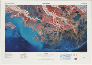
Egleston Square improvement program
192.
Forest Hills improvement area
193.
Historical map of the Emerald Necklace
194.
Neighborhood and census tract boundaries 1980
195.
Parcel 22
196.
Plan of Longwood Medical Area and Mission Hill
197.
Topographic map of Boston, Mass.
198.
Views of the area around Dudley Station in Roxbury
199.
Waterfront project, Pierhead Line, Boston, Mass.
200.
China
« Previous
Next »
1
2
3
4
5
6
7
8
…
224
225
Limit your search
Subject
Real property--Massachusetts--Boston--Maps
2,298
Boston (Mass.)--Maps
2,181
Landowners--Massachusetts--Boston--Maps
2,126
Roxbury (Boston, Mass.)--Maps
353
Dorchester (Boston, Mass.)--Maps
317
Cambridge (Mass.)--Maps
268
Brookline (Mass.)--Maps
237
Real property--Massachusetts--Cambridge--Maps
216
more
Subject
»
Place
North and Central America
8,036
United States
6,653
Suffolk (county)
3,555
Boston
3,415
Massachusetts
3,249
Europe
963
Middlesex (county)
619
Canada
427
more
Place
»
Format
Maps/Atlases
11,163
Manuscripts
215
Prints
51
Books
35
Objects/Artifacts
10
Drawings/Illustrations
8
Posters
4
Available to use
No known restrictions
11,048
Creative Commons license
67
Date
View distribution
Current results range from
1482
to
2023
Date range begin
Date range end
View larger »
Unknown
3
Collection
Norman B. Leventhal Map Center Collection
11,033
Boston and New England Maps (Collection of Distinction)
5,233
Urban Maps (Collection of Distinction)
4,967
Maritime Charts and Atlases (Collection of Distinction)
750
American Revolutionary War-Era Maps (Collection of Distinction)
625
Boston Redevelopment Authority Collection
190
Historic Maps
49
Mapping Boston Collection
20
more
Collection
»
Institution
Boston Public Library
11,116
Salem State University Archives and Special Collections
49
State Library of Massachusetts
27
Private Collection
20
American Antiquarian Society
9
Boston Athenaeum
1