Skip to search
Skip to main content
Skip to first result
Digital Commonwealth
Folders
Sign Up / Log In
Search for
Search
Search
Search
Basic
Advanced
Explore
Map
Collections
Institutions
Formats
For Educators
Primary Source Sets
Lesson Plans
Using Primary Sources
Searching Digital Commonwealth
For Institutions
Join Digital Commonwealth
Conferences, Trainings, & Events
How to Contribute Collections
Digitization Services
Board & Committees
Frequently Asked Questions
About
About Digital Commonwealth
News & Announcements
Copyright & Terms of Use
Harmful Content Statement
Partners
API
Contact Us
Search
Search Constraints
Start Over
Save Search
Your search:
More Like
commonwealth:fn107c17h
✖
Remove constraint More Like: commonwealth:fn107c17h
« Prev.
|
10,901
-
11,000
of
11,222
|
Next »
Sort
by date (asc)
relevance
title
date (asc)
date (desc)
Number of results to display per page
100
per page
per page
10
per page
20
per page
50
per page
100
per page
View results as:
List
list view
Maps
map view
Gallery
grid view
Search Results
10901.
Massachusetts Bay Transportation Authority system route map
10902.
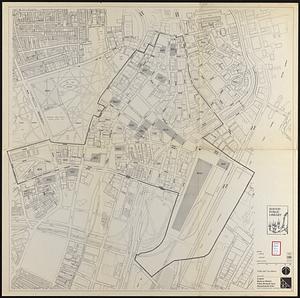
Downtown project no. Mass. r-46 : existing and proposed community facilities
10903.
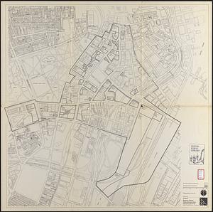
Downtown project no. Mass. r-46 : proposed circulation and boundary adjustments
10904.
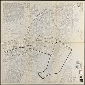
Downtown waterfront-Faneuil Hall urban area Massachusetts R-77 : proposed land use
10905.
Downtown waterfront-Faneuil Hall urban renewal area Massachusetts R-77 : proposed land use
10906.
Central business district urban renewal area r-82 : parcel acquisition map
10907.
Central business district urban renewal area r-82 : existing land use
10908.
Central business district urban renewal area r-82 : building deficiencies
10909.
South Station development study : access plan
10910.
South Station development study : site location and functional areas
10911.
South Station development study : parcel plan
10912.
South Station development study : estimated track retirement
10913.
Boston personal income ; Boston personal income [and] residential population density
10914.
Campus High School urban renewal area Mass. r- : locality map blighted areas
10915.
Campus High School urban renewal area Mass. r- : locality map important features
10916.
Central business district urban renewal area Massachusetts r-82 : pedestrian circulation
10917.
Central business district urban renewal area Massachusetts r-82 : vehicular circulation
10918.
Central business district urban renewal area Massachusetts r-82 : disposition parcels
10919.
Central business district urban renewal area Massachusetts r-82 : acquisition plan
10920.
Central business district urban renewal area Massachusetts r-82 : street adjustments
10921.
Central business district urban renewal area Massachusetts r-82 : zoning plan
10922.
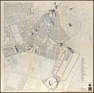
Central business district urban renewal area Massachusetts r-82 : illustrative site plan
10923.
Massachusetts Bay Transportation Authority system route map
10924.
Panorama from the Pinnacle ("Acorn Hill," 1371'), Lyme, N.H.
10925.
Report on the alternate master highway plan for the Boston metropolitan area
10926.
The Scrimshaw historical map of Cape Cod
10927.
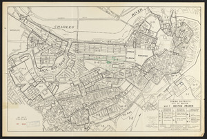
Zoning districts, city of Boston : Map I Boston proper
10928.
Atlas of the town of Wayland
10929.
Inner belt, Southwest Expressway
10930.
Massachusetts Bay Transportation Authority
10931.
Yuenan renmin kang mei jiu guo xing shi tu
10932.
Central business district urban renewal area, Massachusetts r-82 : illustrative site plan
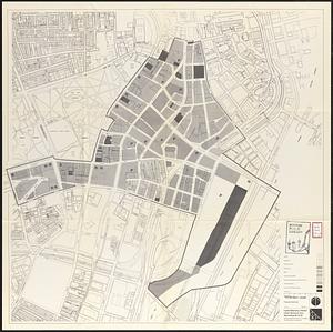
10933.
Central business district urban renewal area, Massachusetts r-82 : illustrative site plan
10934.
Central business district urban renewal area Massachusetts r-82 : disposition parcels
10935.
Central business district urban renewal area Massachusetts r-82 : illustrative site plan
10936.
Central business district urban renewal area Massachusetts r-82 : zoning
10937.
Central business district urban renewal area Massachusetts r-82 : proposed land use
10938.
Central business district urban renewal area Massachusetts r-82 : property map
10939.
Report on improvements to the Boston main drainage system
10940.
Charlestown urban renewal project Boston (Suffolk County) Massachusetts Mass. R-55 : topographic map
10941.
Illustrative site plan : Government Center urban renewal area, Massachusetts R-35
10942.
Off-street parking inventory for the Boston regional core
10943.
One way streets, metered block faces, parking restriction areas and signal locations within the Boston regional core
10944.
Fenway urban renewal area, Massachusetts R-115 : illustrative site plan
10945.
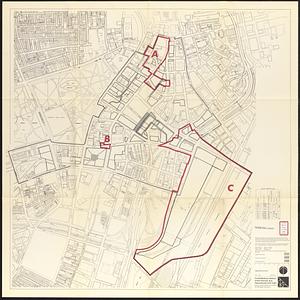
Central business district urban renewal area Massachusetts r-82 A,B,C : disposition parcels
10946.
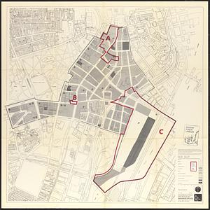
Central business district urban renewal area Massachusetts r-82 A,B,C : proposed land use
10947.
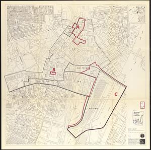
Central business district urban renewal area Massachusetts r-82 A,B,C : zoning
10948.
Atlas of the town of Brookline 1969
10949.
Boston development program
10950.
The regional open space system : [Boston, Massachusetts metropolitan area]
10951.
Waterfront land inventory South Boston : CRP port study
10952.
West Canton Community Park
10953.
Boston bikemap : toward intelligent commuting
10954.
Boylston Street improvements
10955.
Illustration of the south side of Boylston Street between Clarendon and Berkeley Streets
10956.
Illustrative site plan : Washington Park urban renewal area, Massachusetts R-24
10957.
Plans of structures next to the end towers of Longfellow Bridge
10958.
Washington Street corridor : South Cove to Forest Hills
10959.
Campus High School urban renewal area Mass. r-129 : property map
10960.
Index to planning districts
10961.
Kingston-Port-au-Prince
10962.
Public open space city of Boston
10963.
Park Plaza urban renewal area : map no. 4 building deficiencies map
10964.
Park Plaza urban renewal area : map no. 5 ownership data map
10965.
Park Plaza urban renewal area : map no. 2 land use map (existing)
10966.
Park Plaza urban renewal area : map no. 1 boundary map
10967.
Atlas of the town of Brookline 1972
10968.
Baton Rouge
10969.
Major thoroughfare system, city of Boston, June 1972
10970.
Morrisville, Bucks County, Pennsylvania, 1893
10971.
Relationship between selected recreation sites and public transportation facilities Boston metropolitan area 1971
10972.
Downtown waterfront-Faneuil Hall project urban renewal area Massachusetts R-77 : existing and proposed zoning
10973.
Downtown waterfront-Faneuil Hall urban area Massachusetts R-77 : existing and proposed zoning
10974.
Breton Sound
10975.
Carte des Etats-Unis de l'Amerique suivant le Traité de Paix de 1783 : dédiée et présentée a S. Excellence Mr. Benjamin...
10976.
Italy
10977.
Library districts [in Boston]
10978.
Off-street parking inventory within Boston proper
10979.
Park Plaza urban renewal area : environmental deficiencies and blighting influences map
10980.
Downtown waterfront-Faneuil Hall urban renewal area Massachusetts R-77 : proposed land use
10981.
Metropolitan Boston transportation map : subway, bus, rail
10982.
Downtown waterfront-Faneuil Hall project urban renewal area Massachusetts R-77 : illustrative site plan
10983.
Downtown waterfront-Faneuil Hall project urban renewal area Massachusetts R-77 : illustrative site plan
10984.
Boston public schools and police reporting areas
10985.
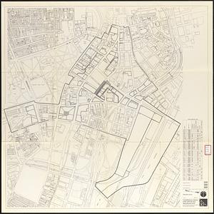
Boston proper
10986.
Charlestown urban renewal area project no. Mass. R-55 Boston - Suffolk County - Massachusetts delivery parcel plan : parcel...
10987.
The good things in life belong to all of us, let's protect them
10988.
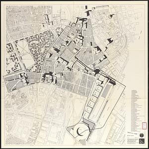
Illustrative re-use site plan for the regional core
10989.
Metropolitan Boston transportation map : subway, bus, rail
10990.
Plan of Lafayette Mall (Boston Common)
10991.
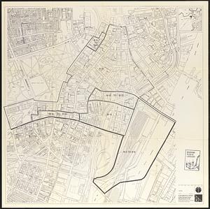
Wards & precincts
10992.
Contract documents for the Waterfront Park, Boston, Massachusetts : planting plan
10993.
Boston Common Brewer Fountain - exist. conditions, demolition plan and site plan for comfort station area
10994.
The 1976 proposed regional open space plan
10995.
Boston urban wilds
10996.
Metropolitan Boston transportation map : subway, bus, rail
10997.
Metropolitan Boston transportation map : subway, bus, rail
10998.
Metropolitan Boston transportation map : subway, bus, rail
10999.
Port facilities at Boston, MA
11000.
Transportation map of New York
« Previous
Next »
1
2
…
106
107
108
109
110
111
112
113
Limit your search
Subject
Real property--Massachusetts--Boston--Maps
2,298
Boston (Mass.)--Maps
2,181
Landowners--Massachusetts--Boston--Maps
2,126
Roxbury (Boston, Mass.)--Maps
353
Dorchester (Boston, Mass.)--Maps
317
Cambridge (Mass.)--Maps
268
Brookline (Mass.)--Maps
237
Real property--Massachusetts--Cambridge--Maps
216
more
Subject
»
Place
North and Central America
8,036
United States
6,653
Suffolk (county)
3,555
Boston
3,415
Massachusetts
3,249
Europe
963
Middlesex (county)
619
Canada
427
more
Place
»
Format
Maps/Atlases
11,163
Manuscripts
215
Prints
51
Books
35
Objects/Artifacts
10
Drawings/Illustrations
8
Posters
4
Available to use
No known restrictions
11,048
Creative Commons license
67
Date
View distribution
Current results range from
1482
to
2023
Date range begin
Date range end
View larger »
Unknown
3
Collection
Norman B. Leventhal Map Center Collection
11,033
Boston and New England Maps (Collection of Distinction)
5,233
Urban Maps (Collection of Distinction)
4,967
Maritime Charts and Atlases (Collection of Distinction)
750
American Revolutionary War-Era Maps (Collection of Distinction)
625
Boston Redevelopment Authority Collection
190
Historic Maps
49
Mapping Boston Collection
20
more
Collection
»
Institution
Boston Public Library
11,116
Salem State University Archives and Special Collections
49
State Library of Massachusetts
27
Private Collection
20
American Antiquarian Society
9
Boston Athenaeum
1


![Boston personal income ; Boston personal income [and] residential population density](https://bpldcassets.blob.core.windows.net/derivatives/images/commonwealth:fn107c409/image_thumbnail_300.jpg)


![Library districts [in Boston]](https://bpldcassets.blob.core.windows.net/derivatives/images/commonwealth:3f465b625/image_thumbnail_300.jpg)


