Skip to search
Skip to main content
Skip to first result
Digital Commonwealth
Folders
Sign Up / Log In
Search for
Search
Search
Search
Basic
Advanced
Explore
Map
Collections
Institutions
Formats
For Educators
Primary Source Sets
Lesson Plans
Using Primary Sources
Searching Digital Commonwealth
For Institutions
Join Digital Commonwealth
Conferences, Trainings, & Events
How to Contribute Collections
Digitization Services
Board & Committees
Frequently Asked Questions
About
About Digital Commonwealth
News & Announcements
Copyright & Terms of Use
Harmful Content Statement
Partners
API
Contact Us
Search
Search Constraints
Start Over
Save Search
Your search:
More Like
commonwealth:fn107c17h
✖
Remove constraint More Like: commonwealth:fn107c17h
« Prev.
|
10,901
-
11,000
of
11,222
|
Next »
Sort
by relevance
relevance
title
date (asc)
date (desc)
Number of results to display per page
100
per page
per page
10
per page
20
per page
50
per page
100
per page
View results as:
List
list view
Maps
map view
Gallery
grid view
Search Results
10901.
View of North Easton, Massachusetts, 1881
10902.
View of North Manchester, Connecticut : 1880
10903.
View of Northborough, Massachusetts : 1887
10904.
View of Oneida, N.Y : 1874
10905.
View of Palmer, Mass
10906.
A view of part of the town of Boston in New-England and Brittish [sic] ships of war landing their troops! 1768
10907.
View of Peabody, Mass : 1877
10908.
A view of Port Hood, sailing into the harbor : A view of the Plaister Cliffs, in George's Bay
10909.
A view of Portsmouth in Piscataqua River
10910.
View of Public Square, Atlanta, Ga.
10911.
View of Putnam, Conn : 1877
10912.
View of Randolph, Mass : 1882
10913.
View of Rockville, Conn : 1877
10914.
View of Saxonville, Mass
10915.
View of Sea Isle City : New Jersey
10916.
View of Seymour, Conn : 1879
10917.
View of Somerset, Massachusetts
10918.
View of South Braintree, Massachusetts : 1882
10919.
View of South Coventry, Conn : 1878
10920.
View of Southbridge, Mass : Center & Globe Village, 1878
10921.
View of SoWa food trucks
10922.
View of Springfield, Mass : 1875
10923.
View of Stafford Springs, Conn : 1878
10924.
View of Stamford, Conn : 1875
10925.
View of Stoneham, Mass : 1878
10926.
View of Stonington, Conn : 1879
10927.
A view of the castle of Belem and the city of Lisbon as it appears from thence ; A map of the mouth of the famous river Tagus...
10928.
View of the city of New Bedford, Mass : 1876
10929.
View of the city of St. Augustine, Fla : the oldest town in the United States, Juan de Ponce de Leon ldd [?] 1512
10930.
View of the city of Waterbury, Conn : 1876
10931.
A view of the country towards Dorchester, taken from the advanced works on Boston Neck : Long Island open on the north side of...
10932.
A view of the east end of the Isle Sable ... : The eastern end of the Isle Sable ... ; A view taken from the south side of the...
10933.
A view of the Rivers Kenebec and Chaudiere, with Colonel Arnold's route to Quebec
10934.
View of the South End
10935.
A view of the taking of Quebeck by the English forces commanded by Gen. Wolfe Sep. 13th 1759
10936.
View of Thompsonville, Conn : 1878
10937.
View of Unionville, Conn : 1878
10938.
View of Wakefield, Mass : 1882
10939.
View of Wallingford, Connecticut : 1881
10940.
View of Waltham, Mass
10941.
View of Warren, Mass : 1879
10942.
View of Warren, R.I : 1877
10943.
View of Watertown, Mass : 1879
10944.
View of Webster, Mass : 1878
10945.
View of Westerly, R.I : 1877
10946.
View of Westport, Conn : 1878
10947.
View of Whitman and Brockton, showing location of some of the most desirable building lots, for sale by W.V. Everson, 120...
10948.
View of Winchendon, Mass : 1878
10949.
View of Winsted, Conn : 1877
10950.
View showing the works of D.S. Morgan & Co., Brockport, N.Y
10951.
Views of London in 1616 and 1890
10952.
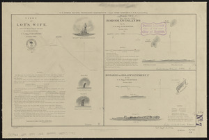
Views of Lot's Wife, taken from Meares' Voyage and from the sketch-book of the U.S. Ship Vincennes, November 1854 ; Borodino...
10953.
Views of Lot's Wife, taken from Meares' Voyage and from the sketch-book of the U.S. Ship Vincennes, November 1854 ; Borodino...
10954.
Views of the area around Dudley Station in Roxbury
10955.
Views of the Boston Harbor Islands
10956.
[Views of the Boston Harbor Islands]
10957.
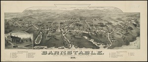
Village of Barnstable, seat of Barnstable County, Mass : 1884
10958.
Village of Kingston, Plymouth County, Mass : 1885
10959.
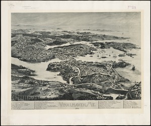
Vinalhaven, Me : 1893
10960.
Vineyard Haven, Dukes County, Martha's Vineyard, Massachusetts : the popular seaside summer resort
10961.
Vineyard Sound and Buzzards Bay, Massachusetts
10962.
Virginia
10963.
Virginia
10964.
Virginia
10965.
Virginia and Maryland
10966.
Virginia, Maryland, Pennsilvania, east & west New Jarsey
10967.
Virginia Marylandia et Carolina in America septentrionali Brittannorum industria excultæ
10968.
Virginiae item et Floridae Americae provincarum, nova descriptio
10969.
Virginiae item et Floridae Americae provinciarum, nova descriptio
10970.
Virginiae partis australis et Floridae partis orientalis, interjacentium[que] regionum nova descriptio
10971.
Virginiae partis australis, et Floridae partis orientalis, interjacentiumq[ue] regionum nova descriptio
10972.
A vision of Private Kutschkes of the German National Guard = Traumgebild des deutschen Landwehrmanns Kutschke!
10973.
Vltoniae orientalis : pars
10974.
Vmbria overo ducato di Spoleto
10975.
Völker und sprachen-karte von Deutschland und den nachbarländern im j. 1867
10976.
Volunteer militia and eastern army guide : One hundred and fifty miles around Richmond
10977.
Vom Rhein bis Paris
10978.
Vorstellung einiger Gegenden und Plaetze in Nord-America unter Franzoesisch und Englische Jurisdiction gehoerig
10979.
Vtriusque Castellae nova descriptio
10980.
La vue a vol d'oiseau de l'Abbaye de Saint-Martin de Laon (de l'Ordre de Prémontré)
10981.
Vue de Quebec, capitale du Canada
10982.
Vue du Port-au-Prince et ses environs
10983.
W. & A.K. Johnston's map to illustrate the Chinese question
10984.
W. & A.K. Johnston's maps to illustrate the Niger and Upper Nile questions
10985.
Wage map no. 1 - Polk Street to Twelfth, Halsted Street to Jefferson, Chicago ; Wage map no. 2 - Polk Street to Twelfth,...
10986.
Wage map no. 3 - Polk Street to Twelfth, Beach Street to Pacific Avenue, Chicago ; Wage map no. 4 - Polk Street to Twelfth,...
10987.
Wahre Bildtnüé der vesten Statt Montavban und wie dieselbe von Königl. Maÿ. in Franckreich belägert worden Anno 1621
10988.
Wakefield and Peace Dale, Rhode Island : 1888
10989.
Wakes Island ; Vatoa or Turtle Island and Vuata Vatoa ; Taloo Harbour, Island of Eimeo
10990.
Die Walachei
10991.
Waldoboro, Lincoln County, Maine, 1896
10992.
Wales
10993.
Walling and Gray's map of the United States and territories
10994.
Wallis's plan of the cities of London & Westminster
10995.
Wallis's tour through the United Kingdom of England, Scotland and Ireland, a new geographical game, comprehending all the...
10996.
Wallowa National Forest, Oregon
10997.
Walpole, Massachusetts : 1882
10998.
Waltham, 1911
10999.
Walworth County, Wis.
11000.
War chart of the Southern States showing the towns, rivers, rail-roads and common roads
« Previous
Next »
1
2
…
106
107
108
109
110
111
112
113
Limit your search
Subject
Real property--Massachusetts--Boston--Maps
2,298
Boston (Mass.)--Maps
2,181
Landowners--Massachusetts--Boston--Maps
2,126
Roxbury (Boston, Mass.)--Maps
353
Dorchester (Boston, Mass.)--Maps
317
Cambridge (Mass.)--Maps
268
Brookline (Mass.)--Maps
237
Real property--Massachusetts--Cambridge--Maps
216
more
Subject
»
Place
North and Central America
8,036
United States
6,653
Suffolk (county)
3,555
Boston
3,415
Massachusetts
3,249
Europe
963
Middlesex (county)
619
Canada
427
more
Place
»
Format
Maps/Atlases
11,163
Manuscripts
215
Prints
51
Books
35
Objects/Artifacts
10
Drawings/Illustrations
8
Posters
4
Available to use
No known restrictions
11,048
Creative Commons license
67
Date
View distribution
Current results range from
1482
to
2023
Date range begin
Date range end
View larger »
Unknown
3
Collection
Norman B. Leventhal Map Center Collection
11,033
Boston and New England Maps (Collection of Distinction)
5,233
Urban Maps (Collection of Distinction)
4,967
Maritime Charts and Atlases (Collection of Distinction)
750
American Revolutionary War-Era Maps (Collection of Distinction)
625
Boston Redevelopment Authority Collection
190
Historic Maps
49
Mapping Boston Collection
20
more
Collection
»
Institution
Boston Public Library
11,116
Salem State University Archives and Special Collections
49
State Library of Massachusetts
27
Private Collection
20
American Antiquarian Society
9
Boston Athenaeum
1


![A view of part of the town of Boston in New-England and Brittish [sic] ships of war landing their troops! 1768](https://bpldcassets.blob.core.windows.net/derivatives/images/commonwealth:4m90f851p/image_thumbnail_300.jpg)


![[Views of the Boston Harbor Islands]](https://bpldcassets.blob.core.windows.net/derivatives/images/commonwealth:1v53jx85b/image_thumbnail_300.jpg)


![Virginiae partis australis et Floridae partis orientalis, interjacentium[que] regionum nova descriptio](https://bpldcassets.blob.core.windows.net/derivatives/images/commonwealth:6t053p120/image_thumbnail_300.jpg)
![Virginiae partis australis, et Floridae partis orientalis, interjacentiumq[ue] regionum nova descriptio](https://bpldcassets.blob.core.windows.net/derivatives/images/commonwealth:st74cw930/image_thumbnail_300.jpg)


