Skip to search
Skip to main content
Skip to first result
Digital Commonwealth
Folders
Sign Up / Log In
Search for
Search
Search
Search
Basic
Advanced
Explore
Map
Collections
Institutions
Formats
For Educators
Primary Source Sets
Lesson Plans
Using Primary Sources
Searching Digital Commonwealth
For Institutions
Join Digital Commonwealth
Conferences, Trainings, & Events
How to Contribute Collections
Digitization Services
Board & Committees
Frequently Asked Questions
About
About Digital Commonwealth
News & Announcements
Copyright & Terms of Use
Harmful Content Statement
Partners
API
Contact Us
Search
Search Constraints
Start Over
Save Search
Your search:
More Like
commonwealth:dz010x12v
✖
Remove constraint More Like: commonwealth:dz010x12v
« Prev. |
1
-
20
of
8,902
|
Next »
Sort
by relevance
relevance
title
date (asc)
date (desc)
Number of results to display per page
20
per page
per page
10
per page
20
per page
50
per page
100
per page
View results as:
List
list view
Maps
map view
Gallery
grid view
Search Results
1.
"A" sketch showing proposed changes of line at Beach & Granite Sts., Rockport, Mass.
2.
Goose Lane off Main St.
3.
Granite St.
4.
Granite St., Pigeon Cove - Folly Cove
5.
Long Cove and adjacent roads
6.
Map of road between Thos. Oake's old house and land of E. Rowe's heirs
7.
Mass. highway layout, Great Hill, Rockport
8.
Part of Town of Rockport showing proposed locations on South St. and Wessex Rd.
9.
Pigeon Hill St.
10.
Plan & profile of extension to Pigeon Hill St., Rockport, Mass.
11.
Plan & profile of extension to Pigeon Hill St., Rockport, Mass.
12.
Plan and profile of Broadway from School St. to Cleaves St., showing locations and grade of proposed drain
13.
Plan and profile of proposed road in Locust Grove Cemetery, Gloucester, Mass.
14.
Plan and profile of proposed state highway in Rockport
15.
Plan and profile of proposed state highway in Rockport
16.
Plan, junction of Parker and High Sts. in Rockport, Mass.
17.
Plan of a portion of Mt. Pleasant St. in the Town of Rockport showing proposed alterations
18.
Plan of a portion of South Street from Thatcher's Road Northerly in the Town of Rockport as altered
19.
Plan of a portion of South Street in the Town of Rockport showing proposed alterations
20.
Plan of a portion of South Street in the Town of Rockport showing proposed alterations
« Previous
Next »
1
2
3
4
5
…
445
446
Limit your search
Subject
Streets
8,750
Buildings
1,295
Cities & towns
830
Houses
720
Sewers
714
Automobiles
575
Stores & shops
516
Snow
435
more
Subject
»
Place
North and Central America
8,284
United States
8,223
Massachusetts
7,774
Essex (county)
3,801
Lawrence
1,549
Suffolk (county)
1,428
Boston
1,260
Newburyport
1,062
more
Place
»
Format
Photographs
5,813
Maps/Atlases
1,676
Manuscripts
1,576
Postcards/Cards
1,080
Prints
322
Drawings/Illustrations
43
Albums/Scrapbooks
22
Ephemera
22
more
Format
»
Available to use
No known restrictions
3,527
Creative Commons license
2,136
Date
View distribution
Current results range from
1756
to
2018
Date range begin
Date range end
View larger »
Unknown
365
Collection
Bill Lane Photograph Collection
931
Lawrence, Mass. Engineering Department. City Sewers
720
Lawrence, Mass. Engineering Department. City Streets
667
Boston Pictorial Archive (Collection of Distinction)
329
Falmouth Public Library Historical Postcard Collection
317
Lynn's Streets
229
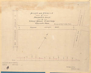
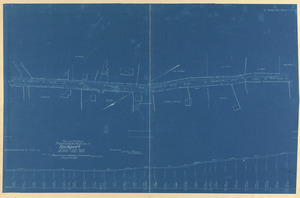
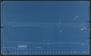
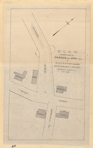
Rockport Town Clerk, Street, Roads and Maps
227
Samuel Chamberlain Photograph Negatives Collection, 1928-1971, undated
218
more
Collection
»
Institution
Boston Public Library
1,796
Lawrence Public Library
1,536
Newburyport Public Library
931
Phillips Library at the Peabody Essex Museum
461
Falmouth Public Library
317
Boston City Archives
245
New Bedford Free Public Library
236
Lynn Public Library
229
more
Institution
»