Skip to search
Skip to main content
Skip to first result
Digital Commonwealth
Folders
Sign Up / Log In
Search for
Search
Search
Search
Basic
Advanced
Explore
Map
Collections
Institutions
Formats
For Educators
Primary Source Sets
Lesson Plans
Using Primary Sources
Searching Digital Commonwealth
For Institutions
Join Digital Commonwealth
Conferences, Trainings, & Events
How to Contribute Collections
Digitization Services
Board & Committees
Frequently Asked Questions
About
About Digital Commonwealth
News & Announcements
Copyright & Terms of Use
Harmful Content Statement
Partners
API
Contact Us
Search
Search Constraints
Start Over
Save Search
Your search:
More Like
commonwealth:cj82kr20j
✖
Remove constraint More Like: commonwealth:cj82kr20j
« Prev.
|
10,761
-
10,780
of
11,000
|
Next »
Sort
by date (asc)
relevance
title
date (asc)
date (desc)
Number of results to display per page
20
per page
per page
10
per page
20
per page
50
per page
100
per page
View results as:
List
list view
Maps
map view
Gallery
grid view
Search Results
10761.
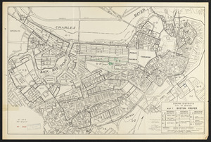
Boston proper
10762.
Massachusetts Bay Transportation Authority system route map
10763.
Boston personal income ; Boston personal income [and] residential population density
10764.
Massachusetts Bay Transportation Authority system route map
10765.
Panorama from the Pinnacle ("Acorn Hill," 1371'), Lyme, N.H.
10766.
The Scrimshaw historical map of Cape Cod
10767.
Zoning districts, city of Boston : Map I Boston proper
10768.
Atlas of the town of Wayland
10769.
Massachusetts Bay Transportation Authority
10770.
Yuenan renmin kang mei jiu guo xing shi tu
10771.
Charlestown urban renewal project Boston (Suffolk County) Massachusetts Mass. R-55 : topographic map
10772.
Illustrative site plan : Government Center urban renewal area, Massachusetts R-35
10773.
Off-street parking inventory for the Boston regional core
10774.
One way streets, metered block faces, parking restriction areas and signal locations within the Boston regional core
10775.
Atlas of the town of Brookline 1969
10776.
Boston development program
10777.
West Canton Community Park
10778.
Boylston Street improvements
10779.
Illustration of the south side of Boylston Street between Clarendon and Berkeley Streets
10780.
Illustrative site plan : Washington Park urban renewal area, Massachusetts R-24
« Previous
Next »
1
2
…
535
536
537
538
539
540
541
542
543
…
549
550
Limit your search
Subject
Real property--Massachusetts--Boston--Maps
2,278
Landowners--Massachusetts--Boston--Maps
2,117
Boston (Mass.)--Maps
1,967
Roxbury (Boston, Mass.)--Maps
351
Dorchester (Boston, Mass.)--Maps
317
Cambridge (Mass.)--Maps
266
Brookline (Mass.)--Maps
236
Real property--Massachusetts--Cambridge--Maps
216
more
Subject
»
Place
North and Central America
7,815
United States
6,434
Suffolk (county)
3,338
Boston
3,198
Massachusetts
3,166
Europe
963
Middlesex (county)
617
Canada
427
more
Place
»
Format
Maps/Atlases
10,941
Manuscripts
214
Prints
51
Books
35
Objects/Artifacts
10
Drawings/Illustrations
8
Posters
4
Available to use
No known restrictions
10,932
Creative Commons license
46
Date
View distribution
Current results range from
1482
to
2023
Date range begin
Date range end
View larger »
Collection
Norman B. Leventhal Map Center Collection
10,999
Boston and New England Maps (Collection of Distinction)
5,106
Urban Maps (Collection of Distinction)
4,847
Maritime Charts and Atlases (Collection of Distinction)
750
American Revolutionary War-Era Maps (Collection of Distinction)
615
Boston Redevelopment Authority Collection
87
Institution
Boston Public Library
11,000


![Boston personal income ; Boston personal income [and] residential population density](https://bpldcassets.blob.core.windows.net/derivatives/images/commonwealth:fn107c409/image_thumbnail_300.jpg)