Skip to search
Skip to main content
Skip to first result
Digital Commonwealth
Folders
Sign Up / Log In
Search for
Search
Search
Search
Basic
Advanced
Explore
Map
Collections
Institutions
Formats
For Educators
Primary Source Sets
Lesson Plans
Using Primary Sources
Searching Digital Commonwealth
For Institutions
Join Digital Commonwealth
Conferences, Trainings, & Events
How to Contribute Collections
Digitization Services
Board & Committees
Frequently Asked Questions
About
About Digital Commonwealth
News & Announcements
Copyright & Terms of Use
Harmful Content Statement
Partners
API
Contact Us
Search
Search Constraints
Start Over
Save Search
Your search:
More Like
commonwealth:9s161g83n
✖
Remove constraint More Like: commonwealth:9s161g83n
« Prev.
|
9,701
-
9,750
of
10,999
|
Next »
Sort
by relevance
relevance
title
date (asc)
date (desc)
Number of results to display per page
50
per page
per page
10
per page
20
per page
50
per page
100
per page
View results as:
List
list view
Maps
map view
Gallery
grid view
Search Results
9701.
Sectional & topographical map of Holmes County, Ohio
9702.
A sectional map of Massachusetts, engraved expressly for Chapin's farm advertiser, 1871 : including the proposed Massachusetts...
9703.
Sectional map of the northern portion of Vancouver Island
9704.
Sectional map of the Old Colony Railroad South Shore, Nantasket Beach and Plymouth lines
9705.
Sections of soundings made by order of the Harbor Committee of 1852
9706.
Secunda Affrice tabula continet Affricam & insulae que circa ipsam sunt
9707.
Secunda Africae tabula
9708.
Secunda Asiae tabula
9709.
Secunda Asie tabula continet Sarmatia ipsius
9710.
Secunda Europae tabula
9711.
Secunda Europe tabula
9712.
Segusiani : partie du dioecese et archevesche de Lyon : Le Bas Forez et Beaujolois : eslectons de Roanne et de Villefranche
9713.
Segusiani : partie du dioese et archevche de Lyon : le Lyonnois et le haut forez : eslections de Lyon, de St. Chamont, et de...
9714.
Selected hurricanes affecting the southern United States 1954-1977
9715.
Senones : Evesché d'Auxerre : Comté et Ballge d'Auxerre : Eslectons. de Clamecy, de Gien, de la Charité, et de Vezelay
9716.
Septentrionalium terrarum descriptio
9717.
Septima Asia tabula continet Margianam, Bactrianam, Sogdianos, Sacas & Scythiam intra Imaū mōtē
9718.
Septima Asiae tabula
9719.
Septima Europa tabula continet Sardininiam & Sicilia insulas
9720.
Septima Europae tabula
9721.
Ser. Reg. Caroli Gustavi victoriolus e Sialandia disccssus facta pace Rothschildenli d. 5 Martij 1658 ; Ser. Reg. Sueciæ...
9722.
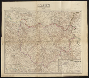
Serbien : nach Österreichischen und Russischen aufnahmen und ortsbestimmungen, und den karten von Viquesnel und Bugarski
9723.
Serio-comic war map for the year 1877
9724.
Al sermo. Ferdinando. II. Grandvca di Toscana svo signore Don Roberto Dudleo, Duca di Northumbria
9725.
Seven miles around Jerusalem : from original surveys and observations
9726.
The Seven United Provinces of Holland, Groningen, Gelders, Friesland, Overyssel, Utrecht and Zealand : from the best authorities
9727.
The Seven United Provinces of Netherland : with its circumjacent borders
9728.
The seven United Provinces, with their roads and divisions
9729.
The Seventh Ward of Philadelphia : the distribution of Negro inhabitants throughout the ward, and their social conditions
9730.
Sexta Asiae tabula
9731.
Sexta Asie tabula continet Arabiam, Felice atq[ue] Carmania cu adiacentibus insulis
9732.
Sexta Europa tabula continet Italiam
9733.
Sexta Europae tabula
9734.
Shadow analysis
9735.
Shah Bay, Loo Choo I.
9736.
Shaker Village
9737.
Shall Union Square overshadow the United States? : America's other 60 families : the real rulers of America
9738.
Shamokin : Pennsylvania, 1884
9739.
A shared problem, an unequal burden : causes & consequences of climate change
9740.
Sheboygan County, Wis.
9741.
Shepherd's map of the seat of war
9742.
Sherman & Smith's rail road, steam boat & stage route map of New England, New-York, and Canada
9743.
Shewey's new map of the city of St. Louis
9744.
Shíjú tú
9745.
Shipyard Park phase 3 : Boston Naval Shipyard at Charlestown : schematic design
9746.
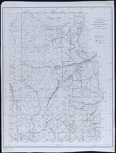
Shoshone National Forest, Wyoming
9747.
Showing rental values in greater Tokyo - 1926
9748.
Siberia
9749.
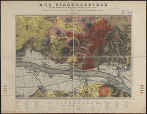
Das Siebengebirge
9750.
The siege of Colberg, from 3d. to 31st. October, 1758
« Previous
Next »
1
2
…
191
192
193
194
195
196
197
198
199
…
219
220
Limit your search
Subject
Real property--Massachusetts--Boston--Maps
2,278
Landowners--Massachusetts--Boston--Maps
2,117
Boston (Mass.)--Maps
1,966
Roxbury (Boston, Mass.)--Maps
351
Dorchester (Boston, Mass.)--Maps
317
Cambridge (Mass.)--Maps
266
Brookline (Mass.)--Maps
236
Real property--Massachusetts--Cambridge--Maps
216
more
Subject
»
Place
North and Central America
7,813
United States
6,432
Suffolk (county)
3,337
Boston
3,197
Massachusetts
3,166
Europe
963
Middlesex (county)
617
Canada
427
more
Place
»
Format
Maps/Atlases
10,940
Manuscripts
215
Prints
51
Books
35
Objects/Artifacts
10
Drawings/Illustrations
8
Posters
4
Available to use
No known restrictions
10,931
Creative Commons license
46
Date
View distribution
Current results range from
1482
to
2023
Date range begin
Date range end
View larger »
Collection
Norman B. Leventhal Map Center Collection
10,999
Boston and New England Maps (Collection of Distinction)
5,104
Urban Maps (Collection of Distinction)
4,845
Maritime Charts and Atlases (Collection of Distinction)
750
American Revolutionary War-Era Maps (Collection of Distinction)
615
Boston Redevelopment Authority Collection
86
Institution
Boston Public Library
10,999


![Sexta Asie tabula continet Arabiam, Felice atq[ue] Carmania cu adiacentibus insulis](https://bpldcassets.blob.core.windows.net/derivatives/images/commonwealth:7h14b122w/image_thumbnail_300.jpg)