Skip to search
Skip to main content
Skip to first result
Digital Commonwealth
Folders
Sign Up / Log In
Search for
Search
Search
Search
Basic
Advanced
Explore
Map
Collections
Institutions
Formats
For Educators
Primary Source Sets
Lesson Plans
Using Primary Sources
Searching Digital Commonwealth
For Institutions
Join Digital Commonwealth
Conferences, Trainings, & Events
How to Contribute Collections
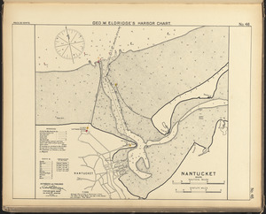
Digitization Services
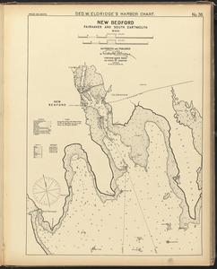
Board & Committees
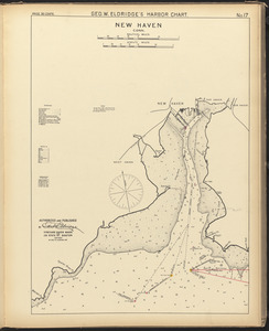
Frequently Asked Questions
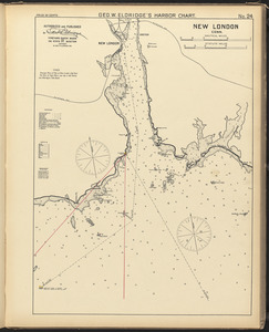
About
About Digital Commonwealth
News & Announcements
Copyright & Terms of Use
Harmful Content Statement
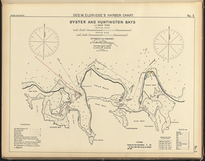
Partners
API
Contact Us
Search
Search Constraints
Start Over
Save Search
Your search:
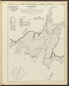
More Like
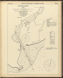
commonwealth:8s45qz88h
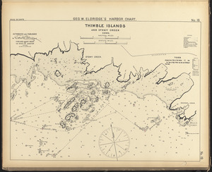
✖
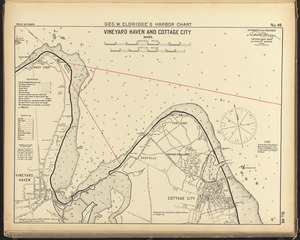
Remove constraint More Like: commonwealth:8s45qz88h
« Prev. |
1
-
100
of
3,028
|
Next »
Sort
by relevance
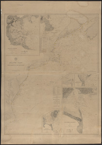
relevance
title
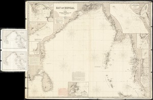
date (asc)
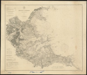
date (desc)
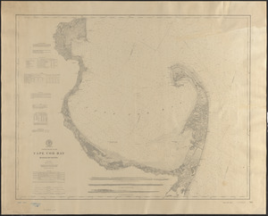
Number of results to display per page
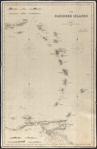
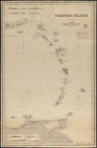
100
per page
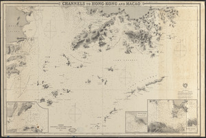
per page
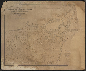
10
per page
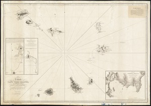
20
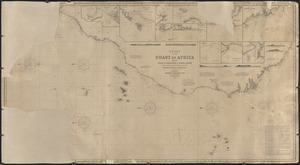
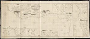
per page
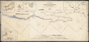
50
per page
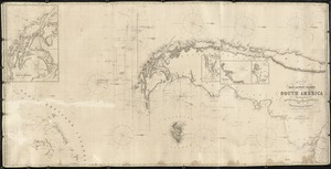
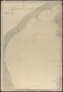
100
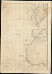
per page
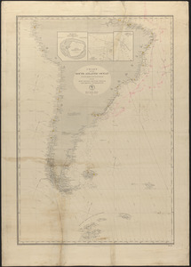
View results as:
List
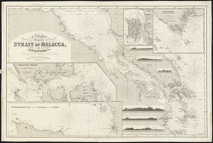
list view
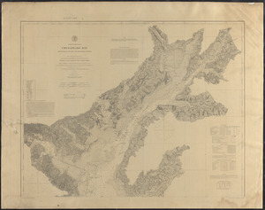
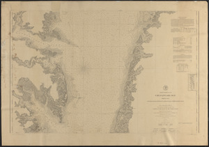
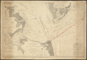
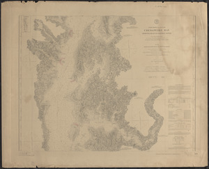
Maps
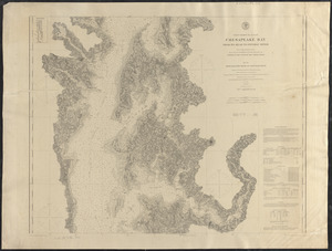
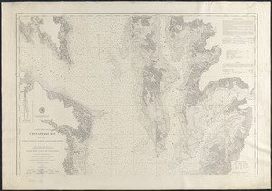
map view
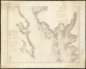
Gallery
grid view
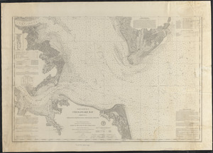
Search Results
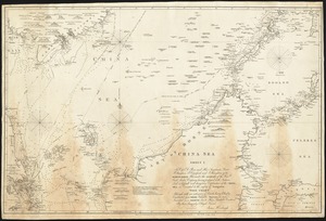
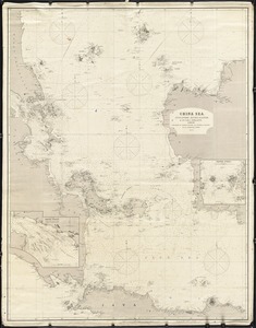
1.
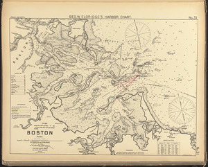
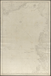
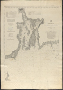
Boston, Mass.
2.
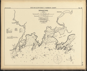
Branford, Conn.
3.
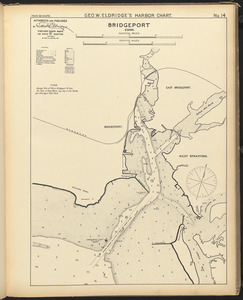
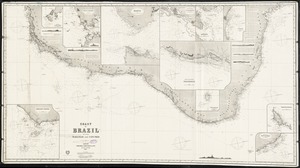
Bridgeport, Conn.
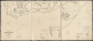
4.
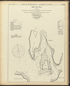
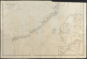
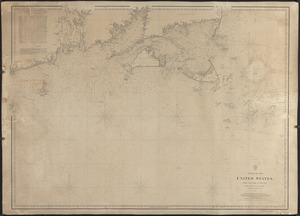
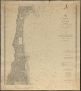
Bristol, R.I.
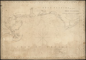
5.
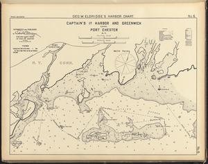
Captain's Id. Harbor and Greenwich, Conn., Port Chester, N.Y.
6.
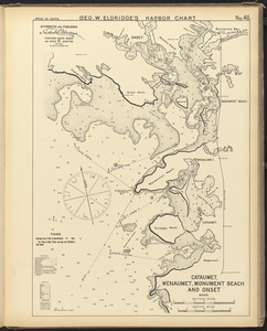
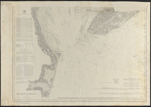
Cataumet, Wenaumet, Monument Beach and Onset, Mass.
7.
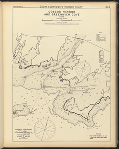
Coscob Harbor and Greenwich Cove, Conn.
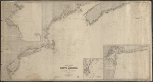
8.
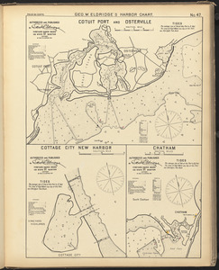
Cotuit Port and Osterville ; Cottage City New Harbor ; Chatham
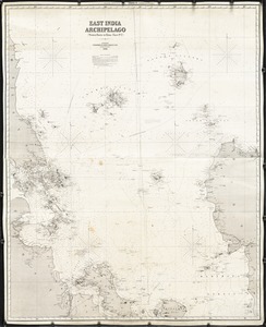
9.
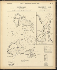
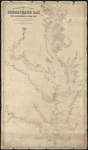
Cuttyhunk, Mass. ; Robinson's Hole, Mass.
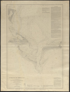
10.
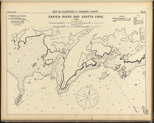
Darien River and Scotts Cove, Conn.
11.
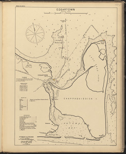
Edgartown
12.
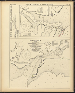
Ent. to Connecticut River or Saybrook Hbr., Conn. ; Black Rock, Conn.
13.
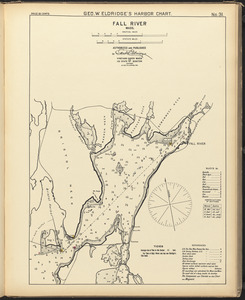
Fall River, Mass.
14.
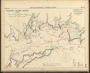
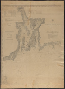
Fishers Island Sound, Conn.
15.
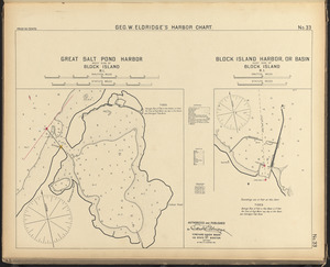
Great Salt Pond Harbor, west side of Block Island, R.I. ; Block Island Harbor, or basin, east side of Block Island, R.I.
16.
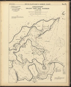
Greenport, Orient, and Sag Harbor, L.I., New York
17.
Greenwich and Apponaug, R.I. ; Wickford, R.I.
18.
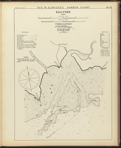
Guilford, Conn.
19.
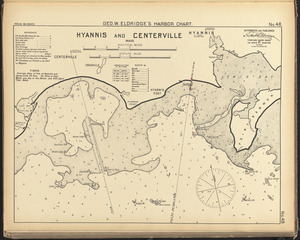
Hyannis and Centerville, Mass.
20.
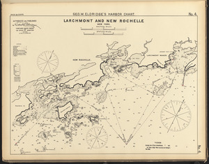
Larchmont and New Rochelle, New York
21.
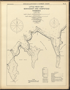
Little Neck Bay, Manhasset and Hempstead Harbors, L.I. New York
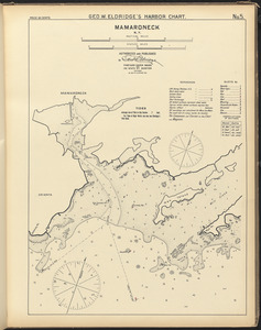
22.
Mamaroneck, N.Y.
23.
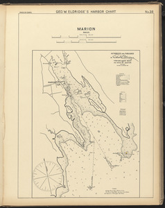
Marion, Mass.
24.
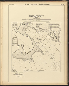
Mattapoisett, Mass.
25.
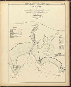
Milford, Conn.
26.
Nantucket, Mass.
27.
New Bedford, Fairhaven and South Dartmouth, Mass.
28.
New Haven, Conn.
29.
New London, Conn.
30.
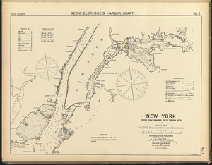
New York, from Governor's Id. to Throgs Neck, N.Y.
31.
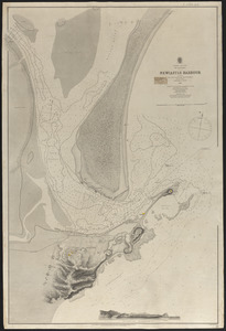
Newcastle Harbour
32.
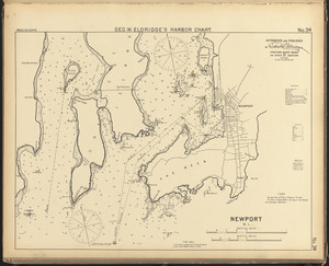
Newport, R.I.
33.
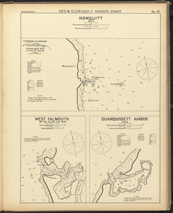
Nonquitt, Mass. ; West Falmouth or Hog Island Har. Mass. ; Quamquissett Harbor, Mass.
34.
Oyster and Huntington Bays, L.I. New York
35.
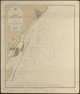
Pernambuco Road, Brazil
36.
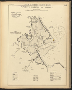
Plymouth, Kingston, and Duxbury
37.
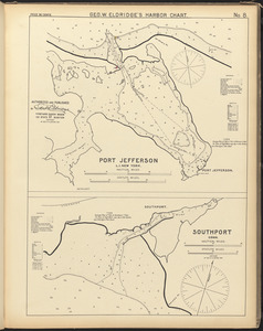
Port Jefferson, L.I. New York ; Southport, Conn.
38.
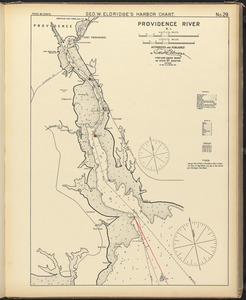
Providence River, R.I.
39.
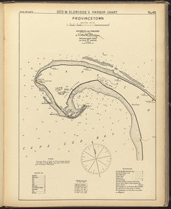
Provincetown
40.
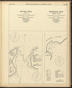
Quicks Hole, Mass. ; Tarpaulin Cove, Naushon Id. Mass.
41.
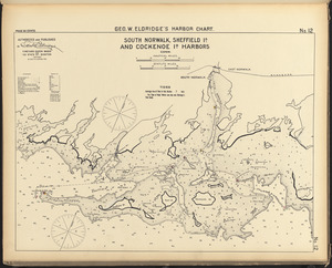
South Norwalk, Sheffield Id. and Cockenoe Id. Harbors, Conn.
42.
Stamford, Conn.
43.
Stratford, Conn.
44.
Thimble Islands and Stony Creek, Conn.
45.
Vineyard Haven and Cottage City, Mass.
46.
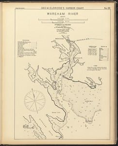
Wareham River, Mass.
47.
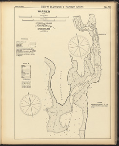
Warren, R.I.
48.
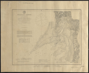
Wellfleet Harbor, Massachusetts
49.
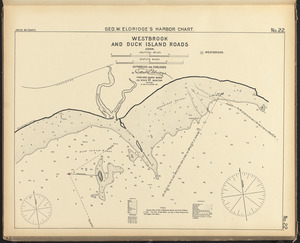
Westbrook and Duck Island Roads, Conn.
50.
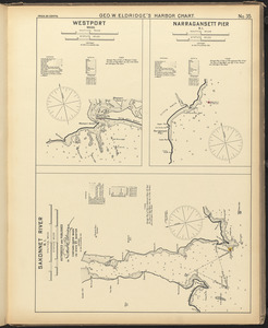
Westport, Mass. ; Narragansett Pier, R.I. ; Sakonnet River, R.I.
51.
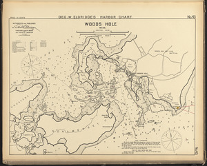
Woods Hole, Mass.
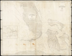
52.
Atlantic Coast, Cape Hatteras to Key West
53.
Atlantic Coast, Cape Sable to Cape Hatteras
54.
Atlantic Coast, Cape Sable to Cape Hatteras
55.
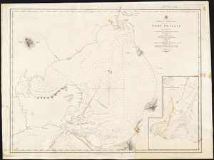
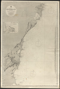
Australia, South Coast, Port Phillip
56.
The Bahama Banks and Gulf of Florida
57.
The Bahama Banks and Gulf of Florida
58.
Bay of Bengal
59.
Boston Harbor, Massachusetts
60.
Cape Cod Bay, Massachusetts
61.
The Caribbee Islands
62.
Caribbee Islands
63.
Channels to Hong Kong and Macao
64.
Chart of Chatham Bay and Stage Harbor
65.
A chart of the Bay of Biscay, with various additions & improvements from the surveys of Tofino, Mechain, & others
66.
A chart of the Cape Verd Islands
67.
Chart of the coast of Africa from the Strait of Gibraltar to Sierra Leone
68.
Chart of the coast of California from San Blas to San Francisco
69.
Chart of the coast of China, from the Canton River to the Yang Tze Keang
70.
Chart of the East and West coasts of South America, extending from the River Plate round Cape Horn to Valparaiso, with plans fo...
71.
Chart of the North Atlantic Ocean from the most recent British, French, Spanish, Potuguese, Belgian, Ducth, German, Danish, and...
72.
Chart of the South Atlantic Ocean from the equator to 65 south latitude, from the most recent British, French, and Brazilian...
73.
A chart of the western coast of Africa, extending from Sierra Leone and the Isles de Los, to the Cape of Good Hope. With...
74.
A chart showing the navigation through the Strait of Malacca, to Singapore, &c
75.
Chesapeake Bay from head of bay to Magothy River
76.
Chesapeake Bay from Magothy River to Choptank River
77.
Chesapeake Bay, sheet no. 1, York River, Hampton Roads, Chesapeake entrance
78.
Chesapeake Bay, sheet no. 2, Rappahannock entrance, Mobjack Bay, Cherrystone Inlet
79.
Chesapeake Bay, sheet no. 3, Potomac entrance, Tangier and Pocomoke Sounds
80.
China Sea
81.
China Sea, Mindoro Strait to Hong Kong
82.
China Sea. Singapore, Banka, Gaspar, & Sunda Straits
83.
Coast Chart No. 31, Chesapeake Bay, sheet no. 1. York River Mapton Roads Chesapeake entrance
84.
Coast Chart No. 34, Chesapeake Bay, from Choptank River to Potomac River
85.
Coast of Brazil, between Maranhao and Cape Frio
86.
The Coast of the Cape Colony
87.
Coast of the United States from New York to Cape Ann
88.
The coasts of West Florida, Alabama, Mississippi & Louisiana; from the surveys of Gauld improved by those of the U.S....
89.
Cuttyhunk to Block Island including Narragansett Bay
90.
Cuttyhunk to Block Island including Narragansett Bay
91.
Delaware Entrance
92.
East coast of Australia, New South Wales, Beecroft Head to Port Jackson
93.
East coast of Australia, New South Wales, Port Jackson to Port Stephens
94.
East coast of North America
95.
East coast of North America from Cape Canso to Delaware Bay
96.
East India Archipelago (West route to China. Chart No. 2)
97.
Eldridge's chart of Chesapeake Bay, with the James, York, Rappahannock and Potomas Rivers
98.
Entrance to Mobile Bay
99.
From Chincoteague Inlet to Hog Island
100.
From Magothy River to Choptank River
« Previous
Next »
1
2
3
4
5
…
30
31
Limit your search
Subject
Harbors
2,912
Boats
953
Piers & wharves
531
Islands
272
Waterfronts
236
Ships
232
Harbors--Provincetown--Mass
201
Provincetown (Mass.)--History--20th century
184
more
Subject
»
Place
North and Central America
2,653
United States
2,594
Massachusetts
2,185
Essex (county)
763
Barnstable (county)
643
Suffolk (county)
378
Boston Harbor
276
Newburyport
268
more
Place
»
Format
Photographs
1,824
Postcards/Cards
621
Prints
241
Maps/Atlases
179
Documents
103
Newspapers
54
Paintings
33
Drawings/Illustrations
26
more
Format
»
Available to use
No known restrictions
1,005
Creative Commons license
989
Date
View distribution
Current results range from
1723
to
2002
Date range begin
Date range end
View larger »
Unknown
240
Collection
Boston Pictorial Archive (Collection of Distinction)
372
Falmouth Public Library Historical Postcard Collection
313
Bill Lane Photograph Collection
310
Samuel Chamberlain Photograph Negatives Collection, 1928-1971, undated
297
Tichnor Brothers Postcard Collection
214
Nautical Chart Collection of the Chatham Historical Society
167
John Dowd Althea Boxell Collection
161
Arthur Griffin Photographs
118
more
Collection
»
Institution
Boston Public Library
1,221
Phillips Library at the Peabody Essex Museum
317
Falmouth Public Library
313
Newburyport Public Library
310
Provincetown History Preservation Project
210
Atwood Museum of the Chatham Historical Society
167
Griffin Museum of Photography
118
New Bedford Free Public Library
84
more
Institution
»