Skip to search
Skip to main content
Skip to first result
Digital Commonwealth
Folders
Sign Up / Log In
Search for
Search
Search
Search
Basic
Advanced
Explore
Map
Collections
Institutions
Formats
For Educators
Primary Source Sets
Lesson Plans
Using Primary Sources
Searching Digital Commonwealth
For Institutions
Join Digital Commonwealth
Conferences, Trainings, & Events
How to Contribute Collections
Digitization Services
Board & Committees
Frequently Asked Questions
About
About Digital Commonwealth
News & Announcements
Copyright & Terms of Use
Harmful Content Statement
Partners
API
Contact Us
Search
Search Constraints
Start Over
Save Search
Your search:
More Like
commonwealth:4m90f405r
✖
Remove constraint More Like: commonwealth:4m90f405r
« Prev.
|
9,701
-
9,720
of
11,000
|
Next »
Sort
by relevance
relevance
title
date (asc)
date (desc)
Number of results to display per page
20
per page
per page
10
per page
20
per page
50
per page
100
per page
View results as:
List
list view
Maps
map view
Gallery
grid view
Search Results
9701.
Section 16: Chemnitz
9702.
Section 16: Chemnitz
9703.
Section of a track chart of the world, covering the Behring Sea
9704.
Sectional & topographical map of Holmes County, Ohio
9705.
A sectional map of Massachusetts, engraved expressly for Chapin's farm advertiser, 1871 : including the proposed Massachusetts...
9706.
Sectional map of the northern portion of Vancouver Island
9707.
Sectional map of the Old Colony Railroad South Shore, Nantasket Beach and Plymouth lines
9708.
Sections of soundings made by order of the Harbor Committee of 1852
9709.
Secunda Affrice tabula continet Affricam & insulae que circa ipsam sunt
9710.
Secunda Africae tabula
9711.
Secunda Asiae tabula
9712.
Secunda Asie tabula continet Sarmatia ipsius
9713.
Secunda Europae tabula
9714.
Secunda Europe tabula
9715.
Segusiani : partie du dioecese et archevesche de Lyon : Le Bas Forez et Beaujolois : eslectons de Roanne et de Villefranche
9716.
Segusiani : partie du dioese et archevche de Lyon : le Lyonnois et le haut forez : eslections de Lyon, de St. Chamont, et de...
9717.
Selected hurricanes affecting the southern United States 1954-1977
9718.
Senones : Evesché d'Auxerre : Comté et Ballge d'Auxerre : Eslectons. de Clamecy, de Gien, de la Charité, et de Vezelay
9719.
Septentrionalium terrarum descriptio
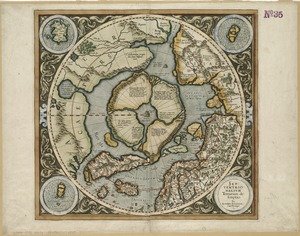
9720.
Septima Asia tabula continet Margianam, Bactrianam, Sogdianos, Sacas & Scythiam intra Imaū mōtē
« Previous
Next »
1
2
…
482
483
484
485
486
487
488
489
490
…
549
550
Limit your search
Subject
Real property--Massachusetts--Boston--Maps
2,278
Landowners--Massachusetts--Boston--Maps
2,117
Boston (Mass.)--Maps
1,966
Roxbury (Boston, Mass.)--Maps
351
Dorchester (Boston, Mass.)--Maps
317
Cambridge (Mass.)--Maps
266
Brookline (Mass.)--Maps
236
Real property--Massachusetts--Cambridge--Maps
216
more
Subject
»
Place
North and Central America
7,814
United States
6,433
Suffolk (county)
3,337
Boston
3,197
Massachusetts
3,166
Europe
964
Middlesex (county)
617
Canada
427
more
Place
»
Format
Maps/Atlases
10,941
Manuscripts
215
Prints
51
Books
35
Objects/Artifacts
10
Drawings/Illustrations
8
Posters
4
Available to use
No known restrictions
10,931
Creative Commons license
46
Date
View distribution
Current results range from
1482
to
2023
Date range begin
Date range end
View larger »
Collection
Norman B. Leventhal Map Center Collection
10,999
Boston and New England Maps (Collection of Distinction)
5,105
Urban Maps (Collection of Distinction)
4,846
Maritime Charts and Atlases (Collection of Distinction)
750
American Revolutionary War-Era Maps (Collection of Distinction)
615
Boston Redevelopment Authority Collection
86
Historic Maps
1
Institution
Boston Public Library
10,999
Salem State University Archives and Special Collections
1