Skip to search
Skip to main content
Skip to first result
Digital Commonwealth
Folders
Sign Up / Log In
Search for
Search
Search
Search
Basic
Advanced
Explore
Map
Collections
Institutions
Formats
For Educators
Primary Source Sets
Lesson Plans
Using Primary Sources
Searching Digital Commonwealth
For Institutions
Join Digital Commonwealth
Conferences, Trainings, & Events
How to Contribute Collections
Digitization Services
Board & Committees
Frequently Asked Questions
About
About Digital Commonwealth
News & Announcements
Copyright & Terms of Use
Harmful Content Statement
Partners
API
Contact Us
Search
Search Constraints
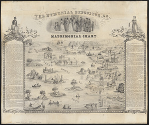
Start Over
Save Search
Your search:
More Like
commonwealth:3f4638283
✖
Remove constraint More Like: commonwealth:3f4638283
« Prev. |
1
-
50
of
11,020
|
Next »
Sort
by relevance
relevance
title
date (asc)
date (desc)
Number of results to display per page
50
per page
per page
10
per page
20
per page
50
per page
100
per page
View results as:
List
list view
Maps
map view
Gallery
grid view
Search Results
1.
The city of New York as laid out by the Commissioners with the surrounding country
2.
Connecticut
3.
Connecticut
4.
Connecticut
5.
Connecticut
6.
Connecticut, from actual survey
7.
Connecticut from the best authorities
8.
Connecticut with portions of New York & Rhode Island
9.
Johnson's Massachusetts Connecticut and Rhode Island
10.
Manuscript maps of U.S. states
11.
Manuscript maps of U.S. states, possibly drawn by a schoolchild
12.
Map of Connecticut
13.
Map of Massachusetts, Connecticut and Rhode Island constructed from the latest authorities
14.
Map of Massachusetts, Connecticut and Rhode Island constructed from the latest authorities
15.
Map of Massachusetts, Connecticut and Rhode Island constructed from the latest authorities
16.
A map of Massachusetts, Connecticut and Rhodeisland
17.
Map of Massachusetts, Rhode-Island & Connecticut : compiled from the latest authorities
18.
Map of Massachusetts, Rhode-Island & Connecticut : compiled from the latest authorities
19.
Massachusetts, Rhode-Island and Connecticut
20.
Massachusetts with Connecticut and Rhode Island
21.
The National Publishing Company's railroad, post office, township and county map of Massachusetts, Rhode Island and Connecticut...
22.
Post route map of the states of Massachusetts, Rhode Island, Connecticut showing post offices with the intermediate distances...
23.
Preliminary geological map of Connecticut
24.
Sketch of the states of Massachusetts, Connecticut, and Rhode Island, and parts of New Hampshire & New York exhibiting the...
25.
Sketch of the states of Massachusetts, Connecticut, and Rhode Island, and parts of New Hampshire & New York exhibiting the...
26.
The state of New York with part of the adjacent states
27.
19th annual convention of the National Association of Real Estate Boards : at Tulsa, June 7 to June 11 in 1926
28.
Acapulco, México
29.
Being a cartograph of Ohio : the oldest state west of the thirteen original colonies; now the fourth state in the Union in...
30.
Bird's eye view of the city of Holyoke, and village of South Hadley Falls, Mass. looking north
31.
Boston kids count
32.
Denmark
33.
A descriptive map of the region within one hundred miles of the capital of the United States : portraying the principal events...
34.
England
35.
France
36.
Germany
37.
Historical map of Watertown, 1630-1930
38.
Holland and Belgium
39.
The hymenial expositor, or, matrimonial chart
40.
Ireland
41.
Italy
42.
Map of a woman's heart
43.
Map of Boston Common : with surrounding streets & adjacent parts of Beacon Hill
44.
A map of Cape Cod
45.
A map of Cape Cod
46.
A map of Concord, the old Musketaquid Plantation
47.
A map of New York which is published by the Washington Square Bookshop
48.
Map of Scituate Rhode Island
49.
A map of the Bermuda Islands : ya des demonios, isles of the devils
50.
Map of the island of Tangerina and Wild Island
« Previous
Next »
1
2
3
4
5
…
220
221
Limit your search
Subject
Real property--Massachusetts--Boston--Maps
2,278
Landowners--Massachusetts--Boston--Maps
2,117
Boston (Mass.)--Maps
1,967
Roxbury (Boston, Mass.)--Maps
351
Dorchester (Boston, Mass.)--Maps
317
Cambridge (Mass.)--Maps
266
Brookline (Mass.)--Maps
236
Real property--Massachusetts--Cambridge--Maps
216
more
Subject
»
Place
North and Central America
7,834
United States
6,449
Suffolk (county)
3,338
Boston
3,198
Massachusetts
3,180
Europe
963
Middlesex (county)
617
Canada
428
more
Place
»
Format
Maps/Atlases
10,961
Manuscripts
215
Prints
51
Books
35
Objects/Artifacts
10
Drawings/Illustrations
8
Posters
4
Available to use
No known restrictions
10,937
Creative Commons license
46
Date
View distribution
Current results range from
1482
to
2023
Date range begin
Date range end
View larger »
Collection
Norman B. Leventhal Map Center Collection
11,004
Boston and New England Maps (Collection of Distinction)
5,111
Urban Maps (Collection of Distinction)
4,847
Maritime Charts and Atlases (Collection of Distinction)
750
American Revolutionary War-Era Maps (Collection of Distinction)
619
Boston Redevelopment Authority Collection
87
Massachusetts Board of Harbor and Land Commissioners
7
David Judkins Weaver Papers
5
more
Collection
»
Institution
Boston Public Library
11,005
State Library of Massachusetts
7
American Antiquarian Society
4
Salem State University Archives and Special Collections
3
Phillips Academy
1