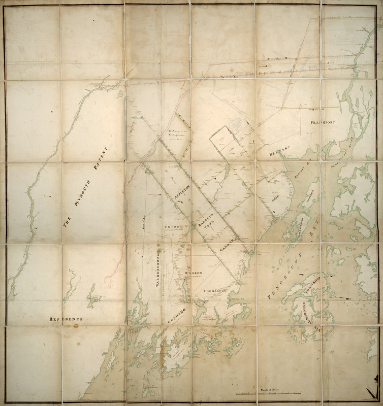
Waldo Patent, District of Maine between 1798 and 1802
Item Information
- Title:
- Waldo Patent, District of Maine between 1798 and 1802
- Date:
-
[1798?–1802?]
- Format:
-
Maps/Atlases
Manuscripts
- Location:
- Boston Athenaeum
- Collection (local):
-
Cartographic Collection
- Subjects:
-
Waldo Patent (Me.)--Early works to 1800
Maine--Maps--Early works to 1800
Penobscot Bay (Me.)--Maps--Early works to 1800
Belfast Bay (Me.)--Maps--Early works to 1800
Penobscot River (Me.)--Maps--Early works to 1800
- Places:
-
MaineWaldo (county)Belfast Bay
MainePenobscot (river)
MainePenobscot (bay)
- Extent:
- 1 map : col. ; 156 x 145 cm. folded to 33 x 26 cm.
- Permalink:
- https://ark.digitalcommonwealth.org/ark:/50959/z603vh46t
- Terms of Use:
-
No known copyright restrictions.
This work is licensed for use under a Creative Commons Attribution Non-Commercial Share Alike License (CC BY-NC-SA).


