Skip to search
Skip to main content
Digital Commonwealth
Sign Up / Log In
Search for
Search
Search
Search
Basic
Advanced
Explore
Map
Collections
Institutions
Formats
For Educators
Primary Source Sets
Lesson Plans
Using Primary Sources
Searching Digital Commonwealth
For Institutions
Join Digital Commonwealth
Conferences, Trainings, & Events
How to Contribute Collections
Digitization Services
Board & Committees
Frequently Asked Questions
About
About Digital Commonwealth
News & Announcements
Copyright & Terms of Use
Harmful Content Statement
Partners
API
Contact Us
American Antiquarian Society
American Revolutionary War-Era Maps (Collection of Distinction)
/
American Antiquarian Society Collection
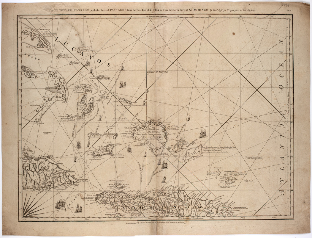
The Windward Passage, with the several passages from the east end of Cuba : & from the north part of St. Domingo
The Windward Passage, with the several passages from the east end of Cuba
×
Item Information
Title:
The Windward Passage, with the several passages from the east end of Cuba : & from the north part of St. Domingo
Description:
Subject: Map of the Windward Passage in the Caribbean, showing parts of Cuba, the Dominican Republic and other islands.
Creator:
Jefferys, Thomas, -1771
Publisher:
Laurie & Whittle
Name on Item:
by Thos. Jefferys geographer to His Majesty.
Date:
1794
Format:
Maps/Atlases
Location:
American Antiquarian Society
Collection (local):
American Antiquarian Society Collection
Subjects:
Windward Passage--Maps
West Indies--Maps
Places:
Windward Passage
West Indies
Extent:
1 map : engraving ; 00 x 00 cm.
Permalink:
https://ark.digitalcommonwealth.org/ark:/50959/z603vh295
Terms of Use:
Public Domain/No known restrictions on use. Contact host institution to download image.
Contact host institution for more information.
Publisher:
London : Published by Laurie & Whittle, no. 53 Fleet Street as the act directs
Scale:
Scale not given
Language:
English
Referenced by:
http://catalog.mwa.org/vwebv/holdingsInfo?bibId=481920
Notes:
Prime meridian: London and Ferro.
Relief shown pictorially. Depths shown by soundings.
In upper right corner: Ch. 8.
From Jefferys, T. Complete pilot for the West-Indies, London, 1794-1805.
show more...
View MODS XML
More Like This
An accurate map of the West Indies, : containing the Bahama & ...
An accurate map of the West Indies
An Accurate map of the West Indies, with the adjacent coast
An accurate map of the West Indies with the adjacent coast of America
Find More Like This >>
Tools
Share
Facebook
Pinterest
X
Reddit
Tumblr
Email
Copy link
Add to Folder
Questions/Comments
Cite This Item
IIIF Manifest