Skip to search
Skip to main content
Digital Commonwealth
Sign Up / Log In
Search for
Search
Search
Search
Basic
Advanced
Explore
Map
Collections
Institutions
Formats
For Educators
Primary Source Sets
Lesson Plans
Using Primary Sources
Searching Digital Commonwealth
For Institutions
Join Digital Commonwealth
Conferences, Trainings, & Events
How to Contribute Collections
Digitization Services
Board & Committees
Frequently Asked Questions
About
About Digital Commonwealth
News & Announcements
Copyright & Terms of Use
Harmful Content Statement
Partners
API
Contact Us
American Antiquarian Society
American Revolutionary War-Era Maps (Collection of Distinction)
/
American Antiquarian Society Collection
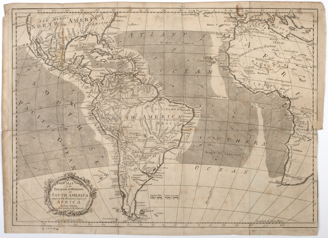
Map of the European settlements in South America and on the western coast of Africa
Map of the European settlements in South America and on the western coast of Africa
×
Item Information
Title:
Map of the European settlements in South America and on the western coast of Africa
Description:
Subject: Map of South America, as well as parts of North and Central America, as well as western Africa.
Creator:
Kitchin, Thomas, 1718-1784
Name on Item:
by Thos. Kitchin hydrographer to His Majesty.
Date:
[1779]
Format:
Maps/Atlases
Location:
American Antiquarian Society
Collection (local):
American Antiquarian Society Collection
Subjects:
North America--Maps
Central America--Maps
Africa--Maps
South America--Maps
Places:
Mesoamerica
(area)
North America
(area)
South America
Africa
Extent:
1 map : engraving ; 33 x 46 cm., on sheet 35 x 48 cm.
Permalink:
https://ark.digitalcommonwealth.org/ark:/50959/z603vg905
Terms of Use:
Public Domain/No known restrictions on use. Contact host institution to download image.
Contact host institution for more information.
Publisher:
Edinburgh : [s.n.]
Scale:
Scale [ca. 1:30,412,000]
Language:
English
Referenced by:
http://catalog.mwa.org/vwebv/holdingsInfo?bibId=481396
Notes:
Prime meridian: Ferro.
Relief shown pictorially.
From Raynal, G.T.F., Philosophical and political history of the British settlements and trade in North America, Edinburgh, 1779.
Notes (date):
This date is inferred.
show more...
View MODS XML
More Like This
Mapa de America sujecto à las observaciones astronomicas
A New map of the whole continent of America, divided into North ...
A New map of the whole continent of America, divided into North ...
Map of the United States of America, the British Provinces, ...
Find More Like This >>
Tools
Share
Facebook
Pinterest
X
Reddit
Tumblr
Email
Copy link
Add to Folder
Questions/Comments
Cite This Item
IIIF Manifest