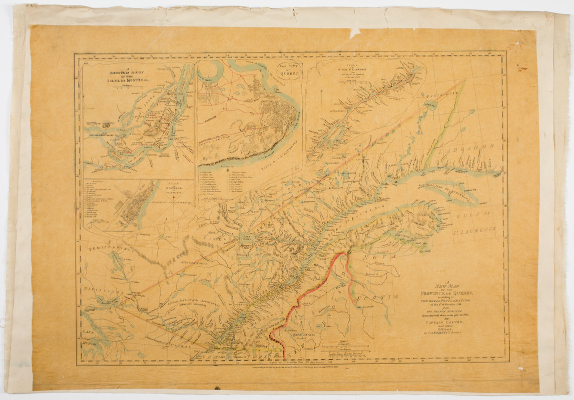
A new map of the province of Quebec, : according to the Royal proclamation, of the 7th of October 1763
A new map of the province of Quebec,
Item Information
Title:
A new map of the province of Quebec, : according to the Royal proclamation, of the 7th of October 1763
Description:
Subject: Map tracing of the province of Quebec along the Saint Lawrence River. Includes four inset maps shown using trompe l'oeil. At lower right is cartouche showing a wooded scene with a waterfall and pond.
Relief shown pictorially.
Tracing of Carver, J. A new map of the province of Quebec, London, 1776.
Inset: A particular survey of the isles of Montreal.
Inset: Plan of Montreal, or Villemarie.
Inset: The city of Quebec.
Inset: Course of the River St. Laurence, from la Vallerie to Quebec.