Skip to search
Skip to main content
Digital Commonwealth
Sign Up / Log In
Search for
Search
Search
Search
Basic
Advanced
Explore
Map
Collections
Institutions
Formats
For Educators
Primary Source Sets
Lesson Plans
Using Primary Sources
Searching Digital Commonwealth
For Institutions
Join Digital Commonwealth
Conferences, Trainings, & Events
How to Contribute Collections
Digitization Services
Board & Committees
Frequently Asked Questions
About
About Digital Commonwealth
News & Announcements
Copyright & Terms of Use
Harmful Content Statement
Partners
API
Contact Us
American Antiquarian Society
American Revolutionary War-Era Maps (Collection of Distinction)
/
American Antiquarian Society Collection
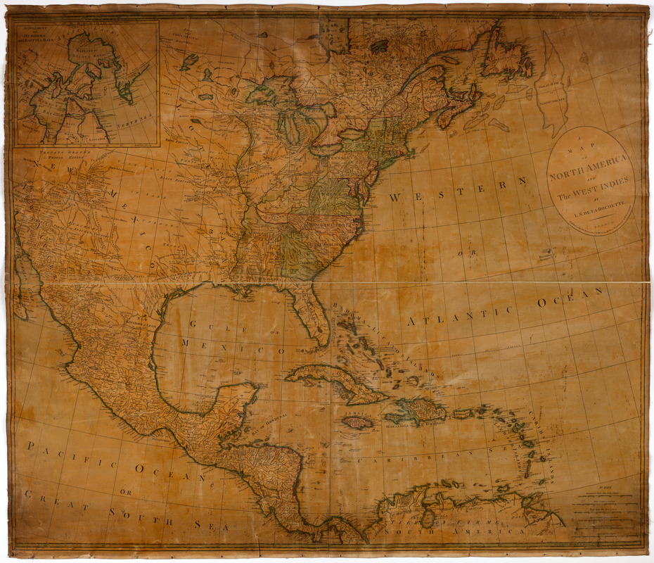
A map of North America and the West Indies
A map of North America and the West Indies
×
Item Information
Title:
A map of North America and the West Indies
Creator:
Delarochette, L. (Louis), 1731-1802
Former owner:
Carr, W.
Bookseller:
Wilkinson, Robert, -approximately 1825
Publisher:
Wilkinson, Robert, -approximately 1825
Former owner:
New England Historic Genealogical Society
Name on Item:
By L.S. de la Rochette.
Date:
[1795]
Format:
Maps/Atlases
Location:
American Antiquarian Society
Collection (local):
American Antiquarian Society Collection
Subjects:
North America--Maps
Places:
North America
(area)
Extent:
1 map on 4 sheets : engraving, hand colored ; 100 x 118 cm., on sheets 53 x 62 cm., or smaller
Permalink:
https://ark.digitalcommonwealth.org/ark:/50959/z603vg51g
Terms of Use:
Public Domain/No known restrictions on use. Contact host institution to download image.
Contact host institution for more information.
Publisher:
London : Published as the Act directs, the 1st of March, 1795, by Robt. Wilkinson, at no. 58 in Cornhill.
Scale:
Scale [ca. 1:5,250,000]
Language:
English
Referenced by:
http://catalog.mwa.org/vwebv/holdingsInfo?bibId=488958
Notes:
Prime meridian: London and Ferro.
Relief shown pictorially.
Inset: Supplement for Hudsons and Baffins Bay.
Notes (date):
This date is inferred.
show more...
View MODS XML
More Like This
An accurate map of North America
Amerique Septentrionale
Carte de l'Amerique Septentrionale depuis le 28 degré de latitude ...
A General map of North America
Find More Like This >>
Tools
Share
Facebook
Pinterest
X
Reddit
Tumblr
Email
Copy link
Add to Folder
Questions/Comments
Cite This Item
IIIF Manifest