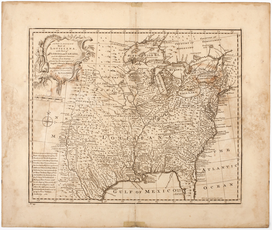
A new & accurate map of Louisiana, with part of Florida and Canada, : and the adjacent countries drawn from surveys assisted by the most approved English & French maps & charts
A new & accurate map of Louisiana, with part of Florida and Canada,
Item Information
Title:
A new & accurate map of Louisiana, with part of Florida and Canada, : and the adjacent countries drawn from surveys assisted by the most approved English & French maps & charts
Description:
Subject: Map of the United States and Canada, showing Louisiana as the land west of the Appalachian Mountains to the border of New Mexico. Shows Florida stretching west to the Mississippi River. Shows the locations of various Native American tribes. Cartouche shows a Native American man.