Skip to search
Skip to main content
Digital Commonwealth
Sign Up / Log In
Search for
Search
Search
Search
Basic
Advanced
Explore
Map
Collections
Institutions
Formats
For Educators
Primary Source Sets
Lesson Plans
Using Primary Sources
Searching Digital Commonwealth
For Institutions
Join Digital Commonwealth
Conferences, Trainings, & Events
How to Contribute Collections
Digitization Services
Board & Committees
Frequently Asked Questions
About
About Digital Commonwealth
News & Announcements
Copyright & Terms of Use
Harmful Content Statement
Partners
API
Contact Us
Westborough Public Library
"Westborough: Your Town - Your History" Scanning Day, 2017
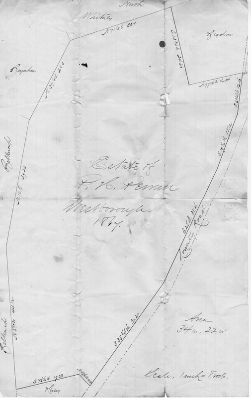
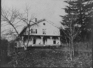
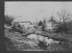
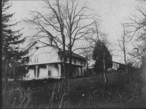
Perrin Farm, 67 Ruggles Street
Perrin Farm, 67 Ruggles Street
×
Item Information
Title:
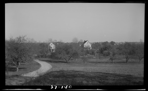
Perrin Farm, 67 Ruggles Street
Description:
A survey map of 67 Ruggles Street, back when it was the Perrin Tree Farm. Carrie Brown, who lives there now, brought this to the 2017 scanning day.
Date:
1867
Format:
Maps/Atlases
Genre:
Plans
Location:
Westborough Public Library
Collection (local):
"Westborough: Your Town - Your History" Scanning Day, 2017
Subjects:
Farms
Places:
Massachusetts
>
Worcester (county)
>
Westborough
Extent:
1 drawing ; sheet 16 x 10 in.
Permalink:
https://ark.digitalcommonwealth.org/ark:/50959/z029pz88s
Terms of Use:
No known copyright restrictions.
No known restrictions on use.
Language:
English
Identifier:
2017.02.017.1
show more...
View MODS XML
More Like This
Perrin Farm, 67 Ruggles Street
Perrin Farm, 67 Ruggles Street
Perrin Farm, 67 Ruggles Street
140 Brookside Rd
Find More Like This >>
Tools
Share
Facebook
Pinterest
X
Reddit
Tumblr
Email
Copy link
Add to Folder
Questions/Comments
Cite This Item
Downloads
Primary (full resolution, uncompressed)
(TIF, 28.7 MB)
Large (full resolution)
(JPEG, 2.41 MB)
Medium
(JPEG, 77 KB)