Map of Boston and its vicinity : from actual surveys
Map of Boston and its vicinity
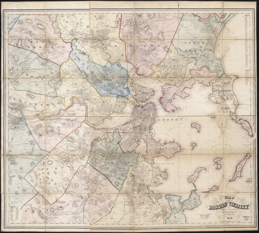
Item Information
Title:
Map of Boston and its vicinity : from actual surveys
Description:
Walling, a Boston-based engineer and surveyor, specialized in publishing landownership maps of individual towns, cities, and counties in New England, but particularly Massachusetts. One example is this extremely detailed map of Boston and vicinity, showing town boundaries, property owners, roads, railroads, and topography. Like many of his other maps, it could be purchased as a folded map stored in a handsome case, or as a wall hanging mounted on rollers. His maps varied greatly in size, some as large as five or six feet square. Information included in these maps was obtained from traveling along existing roads; direction was determined by the surveyors compass and distance by the odometer wheel.