Skip to search
Skip to main content
Digital Commonwealth
Sign Up / Log In
Search for
Search
Search
Search
Basic
Advanced
Explore
Map
Collections
Institutions
Formats
For Educators
Primary Source Sets
Lesson Plans
Using Primary Sources
Searching Digital Commonwealth
For Institutions
Join Digital Commonwealth
Conferences, Trainings, & Events
How to Contribute Collections
Digitization Services
Board & Committees
Frequently Asked Questions
About
About Digital Commonwealth
News & Announcements
Copyright & Terms of Use
Harmful Content Statement
Partners
API
Contact Us
Boston Public Library
Norman B. Leventhal Map Center Collection
/
Urban Maps (Collection of Distinction)
/
Boston and New England Maps (Collection of Distinction)
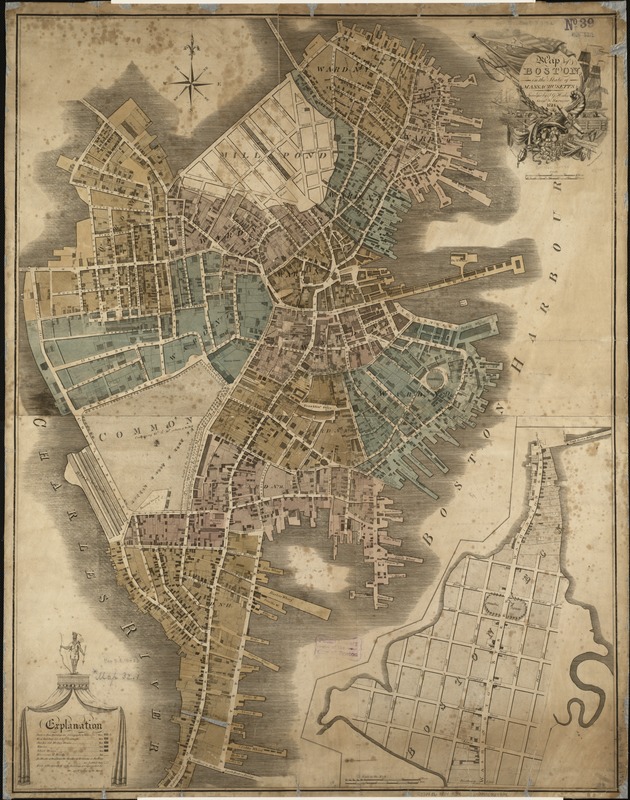
Map of Boston in the state of Massachusetts
Map of Boston in the state of Massachusetts
×
Item Information
Title:
Map of Boston in the state of Massachusetts
Creator:
Hales, John Groves
Name on Item:
surveyed by J.G. Hales ; J.R. Penniman, del. ; engraved by T. Wightman, Jr.
Date:
1814
Format:
Maps/Atlases
Location:
Boston Public Library
Norman B. Leventhal Map Center
Collection (local):
Norman B. Leventhal Map Center Collection
Subjects:
Boston (Mass.)--Maps
Places:
Massachusetts
>
Suffolk (county)
>
Boston
Extent:
1 map : col. ; 92 x 72 cm.
Permalink:
https://ark.digitalcommonwealth.org/ark:/50959/x059cc38s
Terms of Use:
No known copyright restrictions.
No known restrictions on use.
Publisher:
Boston : [s.n.]
Scale:
Scale ca. 1:4,400.
Language:
English
Notes:
Shows wards, and buildings shaded to differentiate between types and building materials.
Inset: Boston Neck. Scale ca. 1:1:3,000.
Identifier:
06_01_005501
Call #:
G3764.B6 1814 .H3x
Barcode:
39999059014934
show more...
View MODS XML
More Like This
Annexation map
Atlas of the city of Boston : Boston proper : from actual surveys ...
Atlas of the city of Boston : Boston proper and Back Bay : from ...
Atlas of the city of Boston : Boston proper and Back Bay : from ...
Find More Like This >>
Tools
Share
Facebook
Pinterest
X
Reddit
Tumblr
Email
Copy link
Add to Folder
Questions/Comments
Cite This Item
IIIF Manifest
Downloads
Primary (full resolution, uncompressed)
(TIF, 141 MB)
Large (full resolution)
(JPEG, 11.9 MB)
Medium
(JPEG, 232 KB)
GeoTIFF (georeferenced)
(TIF, 222 MB)