Skip to search
Skip to main content
Digital Commonwealth
Sign Up / Log In
Search for
Search
Search
Search
Basic
Advanced
Explore
Map
Collections
Institutions
Formats
For Educators
Primary Source Sets
Lesson Plans
Using Primary Sources
Searching Digital Commonwealth
For Institutions
Join Digital Commonwealth
Conferences, Trainings, & Events
How to Contribute Collections
Digitization Services
Board & Committees
Frequently Asked Questions
About
About Digital Commonwealth
News & Announcements
Copyright & Terms of Use
Harmful Content Statement
Partners
API
Contact Us
Boston Public Library
Norman B. Leventhal Map Center Collection
/
Urban Maps (Collection of Distinction)
/
Boston and New England Maps (Collection of Distinction)
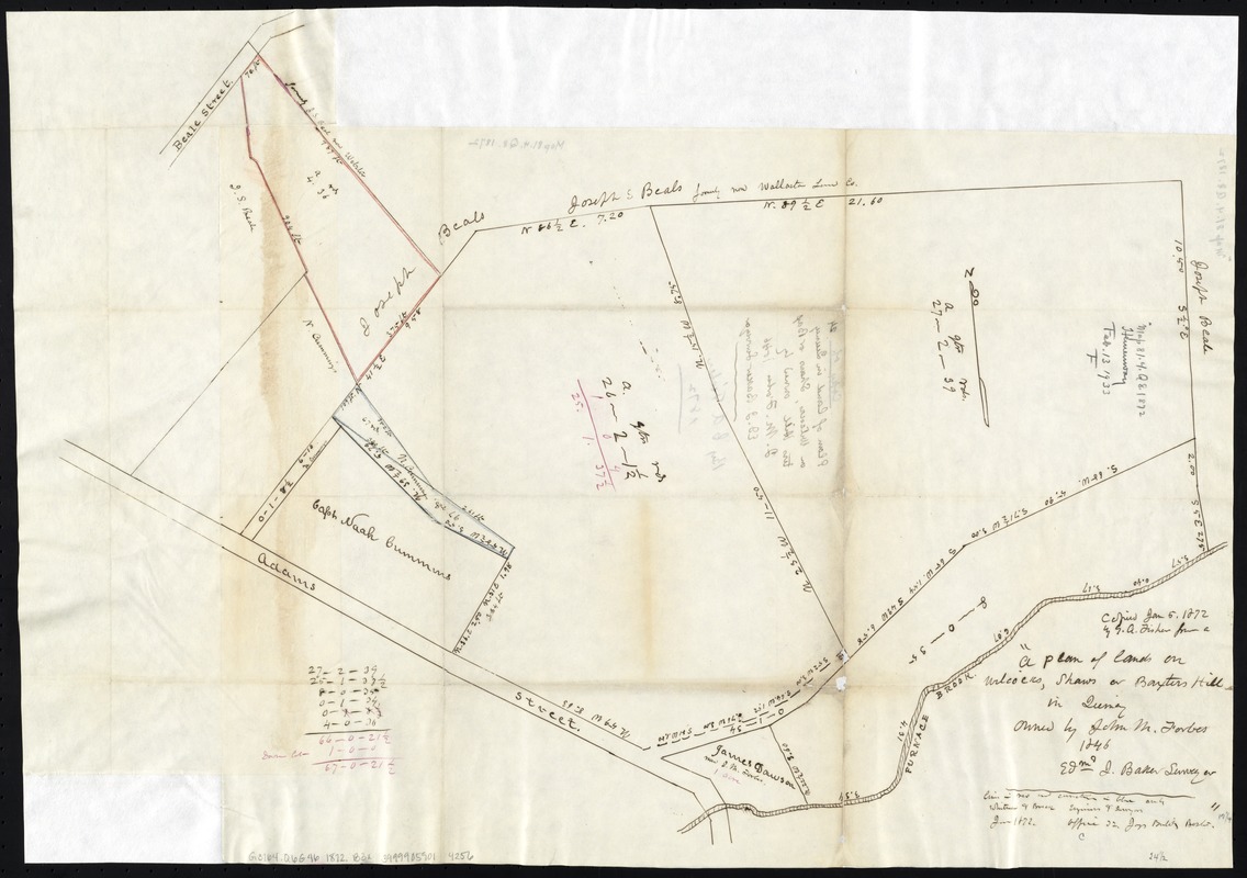
A plan of lands on Wilcocks, Shaws or Baxters Hill in Quincy owned by John M. Forbes 1846
A plan of lands on Wilcocks, Shaws or Baxters Hill in Quincy owned by John M. Forbes 1846
×
Item Information
Title:
A plan of lands on Wilcocks, Shaws or Baxters Hill in Quincy owned by John M. Forbes 1846
Creator:
Baker, Edmund J.
Name on Item:
Edmd. J. Baker, surveyor.
Date:
1872
Format:
Maps/Atlases
Manuscripts
Location:
Boston Public Library
Norman B. Leventhal Map Center
Collection (local):
Norman B. Leventhal Map Center Collection
Subjects:
Landowners--Massachusetts--Quincy--Maps, Manuscript
Real property--Massachusetts--Quincy--Maps, Manuscript
Quincy (Mass.)--Maps, Manuscript
Places:
Norfolk (county)
>
Quincy
Extent:
1 ms. map : col. ; 44 x 61 cm.
Permalink:
https://ark.digitalcommonwealth.org/ark:/50959/x059cb72w
Terms of Use:
No known copyright restrictions.
No known restrictions on use.
Scale:
Scale not given.
Language:
English
Notes:
Oriented with north toward the upper left.
'"Copied Jan. 5, 1872 by G.A. Fisher from ..."
Identifier:
06_01_005430
Call #:
G3764.Q6G46 1872 .B3x
Barcode:
39999059014256
show more...
View MODS XML
More Like This
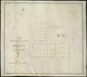
Plan of the Hancock lot given to the town of Quincy by John Adams, ...
The 100th anniversary map of Abraham Lincoln's visit to ...
1630 shoreline
1879. Progress map of the U.S. Geographical Surveys west of the ...
Find More Like This >>
Tools
Share
Facebook
Pinterest
X
Reddit
Tumblr
Email
Copy link
Add to Folder
Questions/Comments
Cite This Item
IIIF Manifest
Downloads
Primary (full resolution, uncompressed)
(TIF, 91.6 MB)
Large (full resolution)
(JPEG, 7.69 MB)
Medium
(JPEG, 208 KB)