Skip to search
Skip to main content
Digital Commonwealth
Sign Up / Log In
Search for
Search
Search
Search
Basic
Advanced
Explore
Map
Collections
Institutions
Formats
For Educators
Primary Source Sets
Lesson Plans
Using Primary Sources
Searching Digital Commonwealth
For Institutions
Join Digital Commonwealth
Conferences, Trainings, & Events
How to Contribute Collections
Digitization Services
Board & Committees
Frequently Asked Questions
About
About Digital Commonwealth
News & Announcements
Copyright & Terms of Use
Harmful Content Statement
Partners
API
Contact Us
Boston Public Library
Norman B. Leventhal Map Center Collection
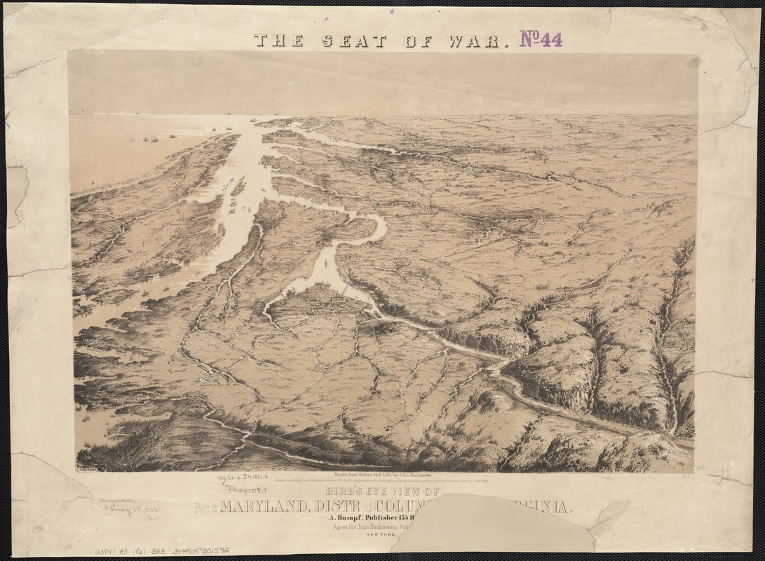
Bird's eye view of part of Maryland, Distr of Columbia and part of Virginia
Birds eye view of part of Maryland, Distr of Columbia and part of Virginia
×
Item Information
Title:
Bird's eye view of part of Maryland, Distr of Columbia and part of Virginia
Title (alt.):
Seat of war, Bird's eye view of part of Maryland, Distr of Columbia and part of Virginia
Creator:
Bachmann, John, fl. 1849-1885
Name on Item:
drawn from nature and lith. by John Bachmann.
Date:
1861
Format:
Maps/Atlases
Location:
Boston Public Library
Norman B. Leventhal Map Center
Collection (local):
Norman B. Leventhal Map Center Collection
Subjects:
United States--History--Civil War, 1861-1865--Aerial views
Maryland--Aerial views
Washington (D.C.)--Aerial views
Virginia--Aerial views
1861
Places:
Virginia
Maryland
Washington
Extent:
1 view : col. ; 34 x 50 cm, on sheet 49 x 60 cm.
Permalink:
https://ark.digitalcommonwealth.org/ark:/50959/x059cb04r
Terms of Use:
No known copyright restrictions.
No known restrictions on use.
Publisher:
New York, N.Y : A. Rumpf
Scale:
Scale not given.
Language:
English
Notes:
Relief shown by shading.
Aerial view of Civil War battlegrounds from Baltimore to Norfolk.
Identifier:
06_01_003558
Call #:
G3841.A3 1861 .B33
Barcode:
39999059001592
show more...
View MODS XML
More Like This
Birds eye view of North and South Carolina and part of Georgia
The 100th anniversary map of Abraham Lincoln's visit to ...
1630 shoreline
1879. Progress map of the U.S. Geographical Surveys west of the ...
Find More Like This >>
Tools
Share
Facebook
Pinterest
X
Reddit
Tumblr
Email
Copy link
Add to Folder
Questions/Comments
Cite This Item
IIIF Manifest
Downloads
Primary (full resolution, uncompressed)
(TIF, 56.4 MB)
Large (full resolution)
(JPEG, 4.74 MB)
Medium
(JPEG, 323 KB)