Skip to search
Skip to main content
Digital Commonwealth
Sign Up / Log In
Search for
Search
Search
Search
Basic
Advanced
Explore
Map
Collections
Institutions
Formats
For Educators
Primary Source Sets
Lesson Plans
Using Primary Sources
Searching Digital Commonwealth
For Institutions
Join Digital Commonwealth
Conferences, Trainings, & Events
How to Contribute Collections
Digitization Services
Board & Committees
Frequently Asked Questions
About
About Digital Commonwealth
News & Announcements
Copyright & Terms of Use
Harmful Content Statement
Partners
API
Contact Us
Boston Public Library
Norman B. Leventhal Map Center Collection
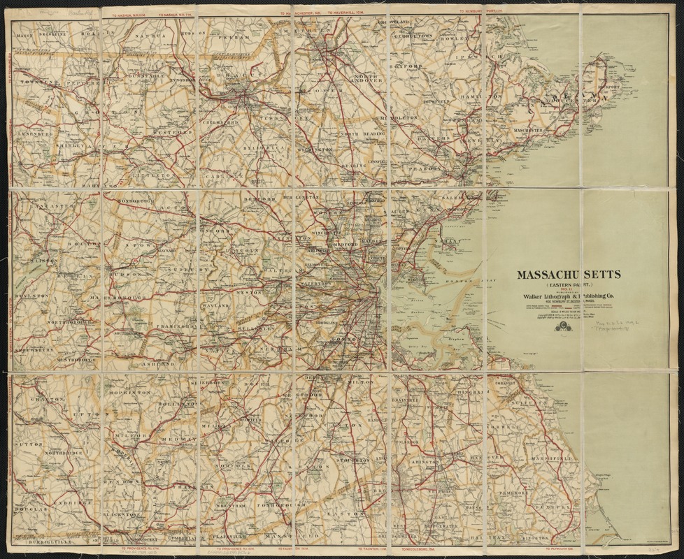
Massachusetts : eastern part, no.11
Massachusetts
×
Item Information
Title:
Massachusetts : eastern part, no.11
Cover title :
Road map of eastern massachusetts
Creator:
Walker Lith. & Pub. Co
Date:
[ca. 1909]
Format:
Maps/Atlases
Location:
Boston Public Library
Norman B. Leventhal Map Center
Collection (local):
Norman B. Leventhal Map Center Collection
Subjects:
Roads--Massachusetts--Maps
Massachusetts--Maps
Places:
Massachusetts
Extent:
1 map : col. ; 69 x 85 cm.
Permalink:
https://ark.digitalcommonwealth.org/ark:/50959/wd3768159
Terms of Use:
No known copyright restrictions.
No known restrictions on use.
Publisher:
Boston, Mass : Walker Lith & Pub. Co.
Scale:
Scale [ca. 1:126,720].
Language:
English
Notes:
Shows major roads in red.
Identifier:
06_01_003108
Call #:
G3760.P2 1909 .W3
Barcode:
39999058998566
show more...
View MODS XML
More Like This
Automobile map of Massachusetts : central section
Boston and its suburban drives
Boston and vicinity
Cyclists' road map of Massachusetts
Find More Like This >>
Tools
Share
Facebook
Pinterest
X
Reddit
Tumblr
Email
Copy link
Add to Folder
Questions/Comments
Cite This Item
IIIF Manifest
Downloads
Primary (full resolution, uncompressed)
(TIF, 188 MB)
Large (full resolution)
(JPEG, 15.8 MB)
Medium
(JPEG, 383 KB)
GeoTIFF (georeferenced)
(TIF, 227 MB)