Skip to search
Skip to main content
Digital Commonwealth
Sign Up / Log In
Search for
Search
Search
Search
Basic
Advanced
Explore
Map
Collections
Institutions
Formats
For Educators
Primary Source Sets
Lesson Plans
Using Primary Sources
Searching Digital Commonwealth
For Institutions
Join Digital Commonwealth
Conferences, Trainings, & Events
How to Contribute Collections
Digitization Services
Board & Committees
Frequently Asked Questions
About
About Digital Commonwealth
News & Announcements
Copyright & Terms of Use
Harmful Content Statement
Partners
API
Contact Us
Boston Public Library
Norman B. Leventhal Map Center Collection
/
Urban Maps (Collection of Distinction)
/
Boston and New England Maps (Collection of Distinction)
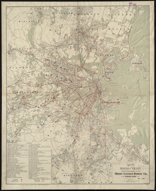
Map of Boston and vicinity showing tracks operated by the Boston Elevated Railway Co., surface lines
Map of Boston and vicinity showing tracks operated by the Boston Elevated Railway Co., surface lines
×
Item Information
Title:
Map of Boston and vicinity showing tracks operated by the Boston Elevated Railway Co., surface lines
Date:
1898
Format:
Maps/Atlases
Location:
Boston Public Library
Norman B. Leventhal Map Center
Collection (local):
Norman B. Leventhal Map Center Collection
Subjects:
Boston Elevated Railway Company
Street-railroads--Massachusetts--Boston--Maps
Boston (Mass.)--Maps
Massachusetts--Maps
Places:
Suffolk (county)
>
Boston
Extent:
1 map : col. ; 86 x 69 cm.
Permalink:
https://ark.digitalcommonwealth.org/ark:/50959/wd376720z
Terms of Use:
No known copyright restrictions.
No known restrictions on use.
Publisher:
Boston, Mass : [Geo. H. Walker & Co.]
Scale:
Scale 1:28,800.
Language:
English
Notes:
Relief shown by spot heights.
Oriented with north toward the upper left.
Includes index to stations.
Identifier:
06_01_003041
Call #:
G3764.B6P33 1898 .M3
Barcode:
39999058997337
show more...
View MODS XML
More Like This
Central part of Boston Elevated Railway system showing connections
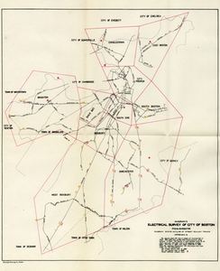
Electrical Survey of City of Boston
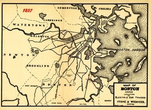
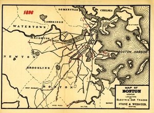
Map of Boston Showing the Location of Electric Car Tracks
Map of Boston Showing the Location of Electric Car Tracks
Find More Like This >>
Tools
Share
Facebook
Pinterest
X
Reddit
Tumblr
Email
Copy link
Add to Folder
Questions/Comments
Cite This Item
IIIF Manifest
Downloads
Primary (full resolution, uncompressed)
(TIF, 196 MB)
Large (full resolution)
(JPEG, 16.4 MB)
Medium
(JPEG, 244 KB)