Skip to search
Skip to main content
Digital Commonwealth
Sign Up / Log In
Search for
Search
Search
Search
Basic
Advanced
Explore
Map
Collections
Institutions
Formats
For Educators
Primary Source Sets
Lesson Plans
Using Primary Sources
Searching Digital Commonwealth
For Institutions
Join Digital Commonwealth
Conferences, Trainings, & Events
How to Contribute Collections
Digitization Services
Board & Committees
Frequently Asked Questions
About
About Digital Commonwealth
News & Announcements
Copyright & Terms of Use
Harmful Content Statement
Partners
API
Contact Us
Boston Public Library
Norman B. Leventhal Map Center Collection
/
Boston and New England Maps (Collection of Distinction)
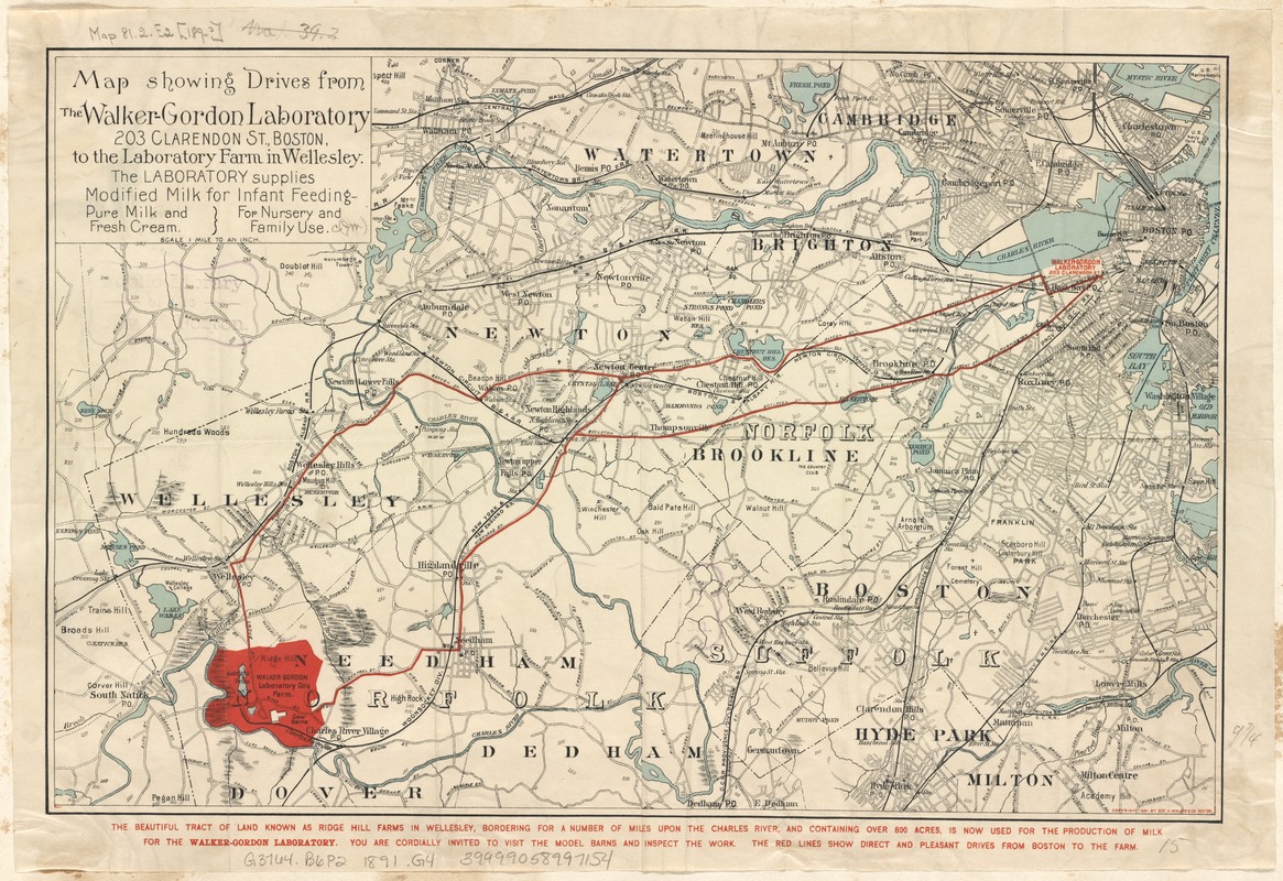
Map showing drives from the Walker-Gordon Laboratory, 203 Claredon St., Boston, to the Laboratory Farm in Wellesley
Map showing drives from the Walker-Gordon Laboratory, 203 Claredon St., Boston, to the Laboratory Farm in Wellesley
×
Item Information
Title:
Map showing drives from the Walker-Gordon Laboratory, 203 Claredon St., Boston, to the Laboratory Farm in Wellesley
Creator:
Geo. H. Walker & Co
Date:
[ca. 1891]
Format:
Maps/Atlases
Location:
Boston Public Library
Norman B. Leventhal Map Center
Collection (local):
Norman B. Leventhal Map Center Collection
Subjects:
Walker-Gordon Laboratory Co.--Maps
Roads--Massachusetts--Boston--Maps
Boston (Mass.)--Maps
Massachusetts--Maps
Places:
Suffolk (county)
>
Boston
Extent:
1 map : hand col. ; 26 x 39 cm.
Permalink:
https://ark.digitalcommonwealth.org/ark:/50959/wd376694j
Terms of Use:
No known copyright restrictions.
No known restrictions on use.
Publisher:
Boston, Mass : Geo. H. Walker & Co.
Scale:
Scale [1:63,360].
Language:
English
Notes:
Shows driving directions between Laboratory properties in red.
Relief shown by spot heights.
"The laboratory supplies modified milk for infant feeding - pure milk and fresh cream for nursery and family use."
Identifier:
06_01_002683
Call #:
G3764.B6P2 1891 .G4
Barcode:
39999058997154
show more...
View MODS XML
More Like This
Massachusetts official transportation map
Motor routes that intersect the Bay Circuit
Gentlemen's driving map showing the park system of Boston
Major thoroughfare system, city of Boston, July 1979
Find More Like This >>
Tools
Share
Facebook
Pinterest
X
Reddit
Tumblr
Email
Copy link
Add to Folder
Questions/Comments
Cite This Item
IIIF Manifest
Downloads
Primary (full resolution, uncompressed)
(TIF, 36.6 MB)
Large (full resolution)
(JPEG, 3.08 MB)
Medium
(JPEG, 441 KB)