Skip to search
Skip to main content
Digital Commonwealth
Sign Up / Log In
Search for
Search
Search
Search
Basic
Advanced
Explore
Map
Collections
Institutions
Formats
For Educators
Primary Source Sets
Lesson Plans
Using Primary Sources
Searching Digital Commonwealth
For Institutions
Join Digital Commonwealth
Conferences, Trainings, & Events
How to Contribute Collections
Digitization Services
Board & Committees
Frequently Asked Questions
About
About Digital Commonwealth
News & Announcements
Copyright & Terms of Use
Harmful Content Statement
Partners
API
Contact Us
Boston Public Library
Norman B. Leventhal Map Center Collection
/
American Revolutionary War-Era Maps (Collection of Distinction)
/
Maritime Charts and Atlases (Collection of Distinction)
La partie Francoise de l'isle de Saint Domingue
La partie Francoise de lisle de Saint Domingue
×
Item Information
Title:
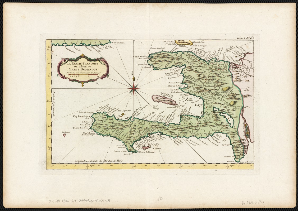
La partie Francoise de l'isle de Saint Domingue
Creator:
Bellin, Jacques Nicolas, 1703-1772
Date:
[1764]
Format:
Maps/Atlases
Location:
Boston Public Library
Norman B. Leventhal Map Center
Collection (local):
Norman B. Leventhal Map Center Collection
Subjects:
Nautical charts--Haiti--Early works to 1800
Nautical charts--Hispaniola--Early works to 1800
Haiti--Maps--Early works to 1800
Hispaniola--Maps--Early works to 1800
Places:
Haiti
Hispaniola
(island)
Extent:
1 map : col. ; 21 x 34 cm.
Permalink:
https://ark.digitalcommonwealth.org/ark:/50959/wd376578z
Terms of Use:
No known copyright restrictions.
No known restrictions on use.
Publisher:
Paris : Bellin
Scale:
Scale not given.
Language:
French
Notes:
Relief shown pictorially.
Depth shown by soundings.
Appears in Bellin's Le petit atlas maritime. Paris, 1764.
"Tome I. No. 67."
Notes (date):
This date is inferred.
Identifier:
06_01_002594
Call #:
G4940 1764 .B4
Barcode:
39999058995943
show more...
View MODS XML
More Like This
Environs de Leogane et du Port Au Prince dans l'Isle de St. Domingue
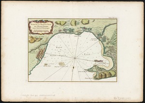
Plan de la Rade et Ville du Petit Goave dans i'Isle de St. Domingue
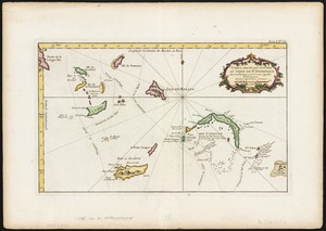
Carte des isles situées au nord de St. Domingue : avec les ...
A chart of the iland of Hispaniola : with the Windward passage ...
Find More Like This >>
Tools
Share
Facebook
Pinterest
X
Reddit
Tumblr
Email
Copy link
Add to Folder
Questions/Comments
Cite This Item
IIIF Manifest
Downloads
Primary (full resolution, uncompressed)
(TIF, 51.8 MB)
Large (full resolution)
(JPEG, 4.35 MB)
Medium
(JPEG, 295 KB)