Skip to search
Skip to main content
Digital Commonwealth
Sign Up / Log In
Search for
Search
Search
Search
Basic
Advanced
Explore
Map
Collections
Institutions
Formats
For Educators
Primary Source Sets
Lesson Plans
Using Primary Sources
Searching Digital Commonwealth
For Institutions
Join Digital Commonwealth
Conferences, Trainings, & Events
How to Contribute Collections
Digitization Services
Board & Committees
Frequently Asked Questions
About
About Digital Commonwealth
News & Announcements
Copyright & Terms of Use
Harmful Content Statement
Partners
API
Contact Us
Boston Public Library
Norman B. Leventhal Map Center Collection
/
Maritime Charts and Atlases (Collection of Distinction)
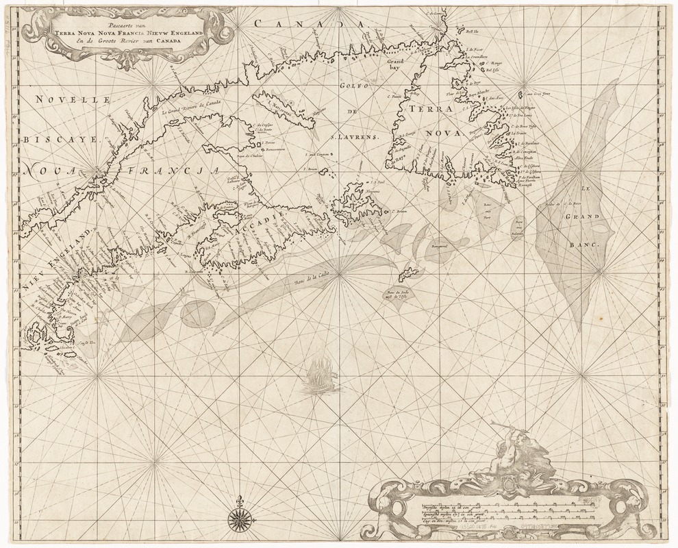
Pascaerte van Terra Nova Nova Francia Nievw Engeland En de Groote Revier van Canada
Pascaerte van Terra Nova Nova Francia Nievw Engeland En de Groote Revier van Canada
×
Item Information
Title:
Pascaerte van Terra Nova Nova Francia Nievw Engeland En de Groote Revier van Canada
Creator:
Roggeveen, Arent, d. 1679
Date:
[1675]
Format:
Maps/Atlases
Location:
Boston Public Library
Norman B. Leventhal Map Center
Collection (local):
Norman B. Leventhal Map Center Collection
Subjects:
Nautical charts--Atlantic Coast (North America)--Early works to 1800
New France--Maps--Early works to 1800
New England--Maps--Early works to 1800
Saint Lawrence River--Maps--Early works to 1800
Places:
North America
(area)
New England
(area)
New France
(former administrative division)
Saint Lawrence River
Extent:
1 map ; 44 x 53 cm.
Permalink:
https://ark.digitalcommonwealth.org/ark:/50959/wd3763069
Terms of Use:
No known copyright restrictions.
No known restrictions on use.
Publisher:
Amsterdam : Roggeveen
Scale:
Scale [ca. 1:4,800,000]
Language:
Dutch
French
Notes:
Appears in Rooggeveen's Het Eerste Deel Van Het Brandende Veen. 1675.
First state.
Notes (date):
This date is inferred.
Identifier:
06_01_002315
Call #:
G3320 1675 .R6
Barcode:
39999058993922
show more...
View MODS XML
More Like This
A new chart of the coast of New England, Nova Scotia, New France ...
An actual survey of the sea coast from New York to the I. Cape ...
A map of the coast of New England, from Staten Island to the ...
An actual survey of the sea coast from New York to the I. Cape ...
Find More Like This >>
Tools
Share
Facebook
Pinterest
X
Reddit
Tumblr
Email
Copy link
Add to Folder
Questions/Comments
Cite This Item
IIIF Manifest
Downloads
Primary (full resolution, uncompressed)
(TIF, 93.2 MB)
Large (full resolution)
(JPEG, 7.83 MB)
Medium
(JPEG, 350 KB)