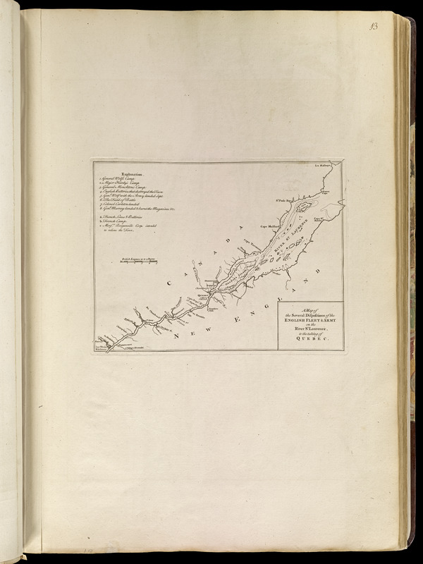
Map of the St. Lawrence River in Canada showing the English and French military camps, the field of battle, batteries, lines and landings in the taking of Quebec in 1759.
Includes references to points of interest.
Appears in Jefferys' General topography of North America and the West Indies. London: Printed for Robert Sayer, ... and Thomas Jefferys, 1768.