Skip to search
Skip to main content
Digital Commonwealth
Sign Up / Log In
Search for
Search
Search
Search
Basic
Advanced
Explore
Map
Collections
Institutions
Formats
For Educators
Primary Source Sets
Lesson Plans
Using Primary Sources
Searching Digital Commonwealth
For Institutions
Join Digital Commonwealth
Conferences, Trainings, & Events
How to Contribute Collections
Digitization Services
Board & Committees
Frequently Asked Questions
About
About Digital Commonwealth
News & Announcements
Copyright & Terms of Use
Harmful Content Statement
Partners
API
Contact Us
Boston Public Library
Norman B. Leventhal Map Center Collection
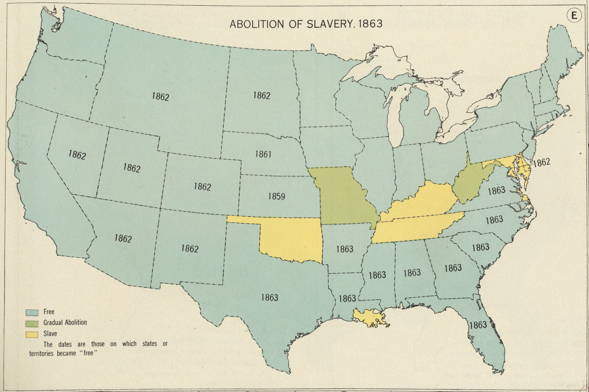
Abolition of Slavery, 1863
Abolition of Slavery, 1863
×
Item Information
Title:
Abolition of Slavery, 1863
Cartographer:
Paullin, Charles Oscar, 1868 or 1869-1944
Editor:
Wright, John Kirtland, 1891-1969
Date:
1932
Format:
Maps/Atlases
Location:
Boston Public Library
Norman B. Leventhal Map Center
Collection (local):
Norman B. Leventhal Map Center Collection
Subjects:
United States--Maps
Slavery--United States--Maps
Antislavery movements--United States--Maps
Places:
Extent:
1 map : color ; 16 x 23 cm
Permalink:
https://ark.digitalcommonwealth.org/ark:/50959/q524n310z
Terms of Use:
Copyright (c) Carnegie Institution of Washington.
All rights reserved.
Publisher:
[Washington, D.C.] : Carnegie Institution of Washington
Scale:
Scale not given
Language:
English
Notes:
From "Atlas of the historical geography of the United States" of 1932.
Identifier:
06_01_004649
Call #:
G1201.S1 P3 1932
Barcode:
39999065703199
show more...
View MODS XML
More Like This
Lewis' free soil, slavery, and territorial map of the United States
Map of the United States, showing by colors the area of freedom ...
Map of the Southern States, showing the relative proportion of ...
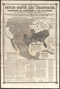
Map of the United States and territories, showing the possessions ...
Find More Like This >>
Tools
Share
Facebook
Pinterest
X
Reddit
Tumblr
Email
Copy link
Add to Folder
Questions/Comments
Cite This Item
IIIF Manifest