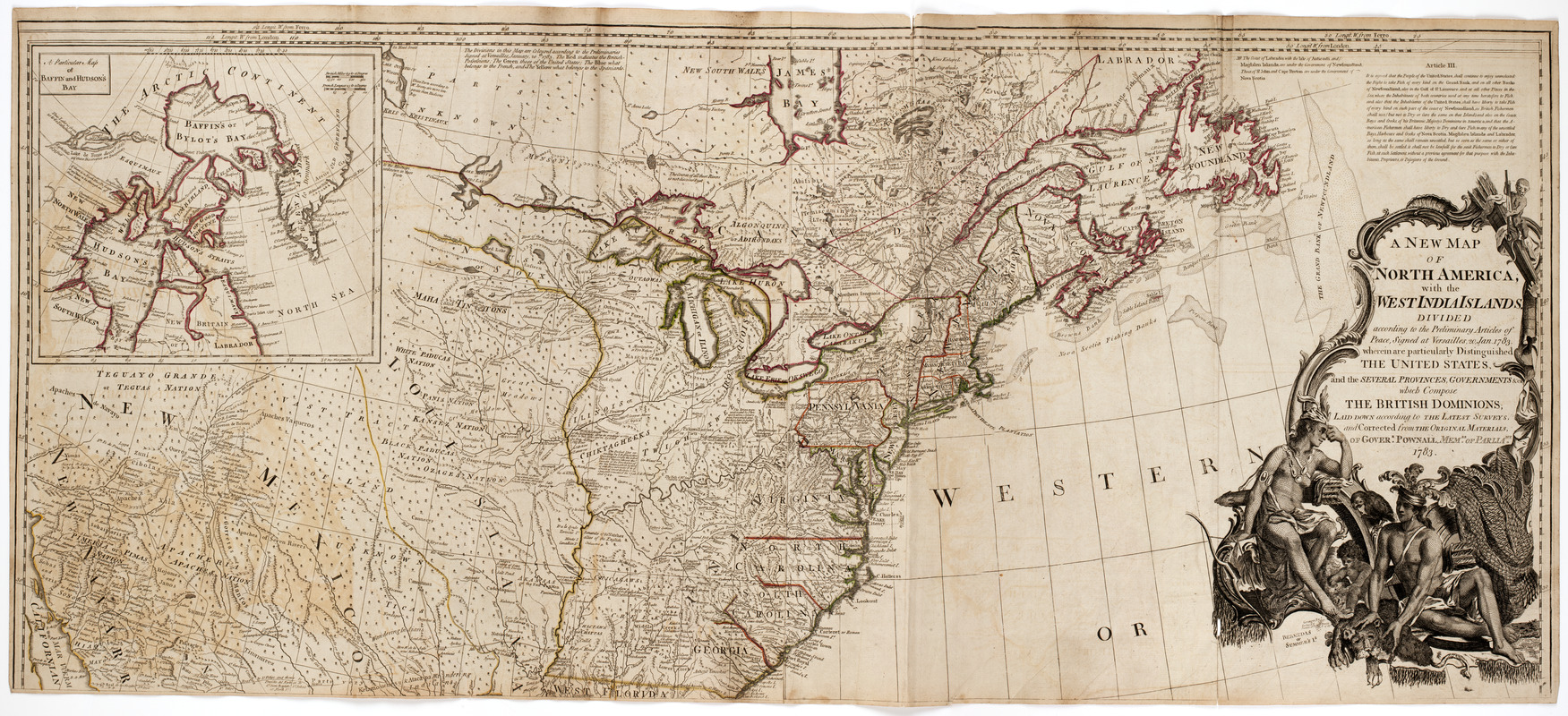
A New map of North America : with the West India Islands. : Divided according to the preliminary articles of Peace, signed at Versailles, 20 Jan. 1783. Wherein are particularly distinguished the United States, and the several provinces, governments &ca. : Which compose the British dominions; laid down according to the latest surveys, and corrected from the original materials, of Goverr. Pownall membr. of Paliamt. 1783
Item Information
- Title:
- A New map of North America : with the West India Islands. : Divided according to the preliminary articles of Peace, signed at Versailles, 20 Jan. 1783. Wherein are particularly distinguished the United States, and the several provinces, governments &ca. : Which compose the British dominions; laid down according to the latest surveys, and corrected from the original materials, of Goverr. Pownall membr. of Paliamt. 1783
- Description:
-
Map of North America showing Canada, United States, Mexico, Central America and the West Indies. Also shows the locations of the various Native American tribes. Cartouche at upper right shows a Native American man, woman and child. The man and woman each hold quivers, and the woman holds a bow.
- Publisher:
- Sayer, Robert, 1725-1794
- Date:
-
[1786?]
- Format:
-
Maps/Atlases
- Location:
- American Antiquarian Society
- Collection (local):
-
American Antiquarian Society Collection
- Subjects:
-
Indians of North America--Pictorial works
North America--Maps
- Places:
-
North America (area)
- Extent:
- 1 map on 4 sheets : engraving, hand colored ; 102 x 116 cm., on sheets 53 x 60 cm. or smaller
- Permalink:
- https://ark.digitalcommonwealth.org/ark:/50959/q524mt31w
- Terms of Use:
-
No known copyright restrictions.
This work is licensed for use under a Creative Commons Attribution Non-Commercial Share Alike License (CC BY-NC-SA).


