Det Kongelige Bibliotek (Royal Danish Library)Det Kongelige Bibliotek (Royal Danish Library) Collection / American Revolutionary War-Era Maps
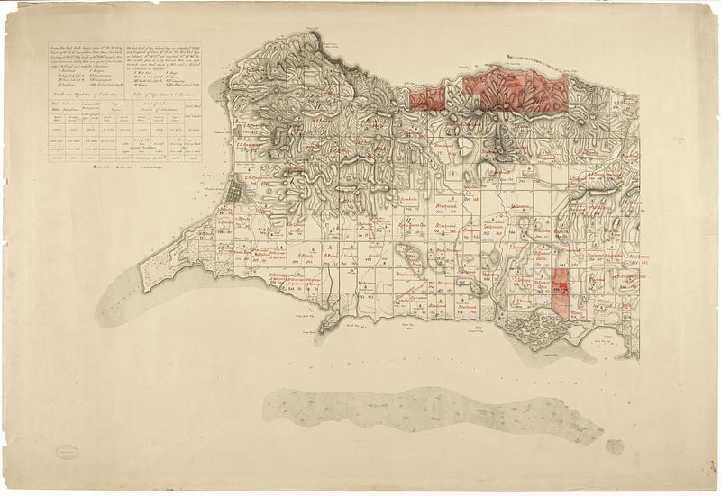
St. Croix
Item Information
- Title:
- St. Croix
- Creator:
- Oxholm, Peter Lotharius, 1753-1827
- Name on Item:
-
optaget af General Oxholm ; Havnen ved Christianstæd efter ... Rohde ; Farvandet udenfor efter A. Lang
- Date:
-
1799
- Format:
-
Maps/Atlases
- Location:
- Det Kongelige Bibliotek (Royal Danish Library)
- Collection (local):
-
Det Kongelige Bibliotek (Royal Danish Library) Collection
- Subjects:
-
Saint Croix (United States Virgin Islands)--Maps
Christiansted (United States Virgin Islands)--Maps
- Places:
-
Virgin Islands of the United States (territory) > Saint Croix (island)
- Extent:
- 1 map in color on 2 sheets 72 x 105 cm
- Permalink:
- https://ark.digitalcommonwealth.org/ark:/50959/pg15k906w
- Terms of Use:
-
No known copyright restrictions.
Contact host institution for more information.
- Place of origin:
-
Denmark
- Scale:
-
Scale of a Danish mile or 24 000 feet [= 310 mm]
- Language:
-
Danish
- Referenced by:
-
Catalog record
- Notes:
-
Engraving.
With an overview of the districts and a table of the population and agriculture in Danish and English.
The plantations are indicated with numbers and names, the districts with Roman numerals. New numbers and names have been added with blue and red marker. Some parts of the map are colored with pink color.
- Identifier:
-
511455
