Skip to search
Skip to main content
Digital Commonwealth
Sign Up / Log In
Search for
Search
Search
Search
Basic
Advanced
Explore
Map
Collections
Institutions
Formats
For Educators
Primary Source Sets
Lesson Plans
Using Primary Sources
Searching Digital Commonwealth
For Institutions
Join Digital Commonwealth
Conferences, Trainings, & Events
How to Contribute Collections
Digitization Services
Board & Committees
Frequently Asked Questions
About
About Digital Commonwealth
News & Announcements
Copyright & Terms of Use
Harmful Content Statement
Partners
API
Contact Us
Town of Rockport
Rockport Town Clerk, Street, Roads and Maps
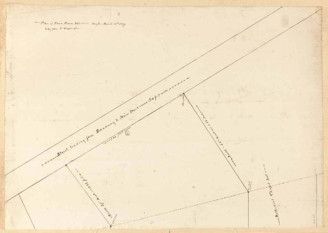
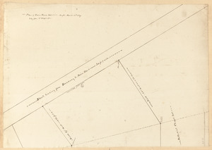
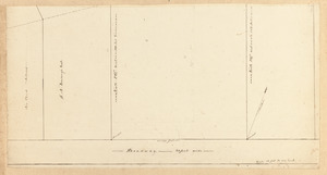
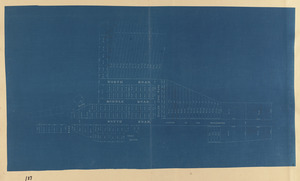
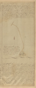
Plan of town house lot
Viewing image 1 of 2
Next >
Plan of town house lot
×
Next
Item Information
Title:
Plan of town house lot
Date:
[ca. March 13, 1869–1974]
Format:
Maps/Atlases
Manuscripts
Genre:
Planning drawings
Manuscript maps
Location:
Town of Rockport
Collection (local):
Streets, Roads and Maps of Rockport, MA 1823-1974 (approximate)
Places:
Massachusetts
>
Essex (county)
>
Rockport
Extent:
1 map on 2 sheets : ms. ; sheets 41 x 59 cm and 30 x 59 cm
Permalink:
https://ark.digitalcommonwealth.org/ark:/50959/m326mj24v
Terms of Use:
Rights status not evaluated.
No known restrictions on use.
Scale:
Scale 1:120
Language:
English
Notes:
Title from item.
Notes (date):
Date supplied by cataloger.
Identifier:
27
64-b
248
64-a
show more...
View MODS XML
More Like This
"A" sketch showing proposed changes of line at Beach & Granite ...
Bearskin Neck lots
Cape Ann Tool Company
Cogswell Farm Landing
Find More Like This >>
Tools
Share
Facebook
Pinterest
X
Reddit
Tumblr
Email
Copy link
Add to Folder
Questions/Comments
Cite This Item
Downloads
Primary (full resolution, uncompressed)
(TIF, multi-file ZIP, 119 MB)
Large (full resolution)
(JPEG, multi-file ZIP, 1.05 MB)
Medium
(JPEG, multi-file ZIP, 358 KB)