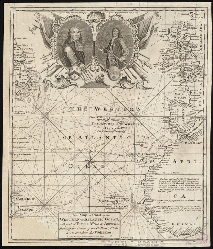
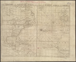
A new map or chart of the Western or Atlantic Ocean, with part of Europe Africa & America : showing the course of galleons, flota &c. to and from the West Indies
A new map or chart of the Western or Atlantic Ocean, with part of Europe Africa & America
Item Information
Title:
A new map or chart of the Western or Atlantic Ocean, with part of Europe Africa & America : showing the course of galleons, flota &c. to and from the West Indies
Shows North Atlantic Ocean with ship routes to Spain and England from Latin America.
Depths shown by shading.
Appears in the Gentlemen's Magazine. London. Vol. 10, 1740.
Includes cartouche with portraits: "Robert Blake Admiral of England &c. 1650" and "Edward Vernon Esqr. Vice Admiral of the Blue 1740."
Cataloging, conservation, and digitization made possible in part by The National Endowment for the Humanities: Exploring the human endeavor.