Skip to search
Skip to main content
Digital Commonwealth
Sign Up / Log In
Search for
Search
Search
Search
Basic
Advanced
Explore
Map
Collections
Institutions
Formats
For Educators
Primary Source Sets
Lesson Plans
Using Primary Sources
Searching Digital Commonwealth
For Institutions
Join Digital Commonwealth
Conferences, Trainings, & Events
How to Contribute Collections
Digitization Services
Board & Committees
Frequently Asked Questions
About
About Digital Commonwealth
News & Announcements
Copyright & Terms of Use
Harmful Content Statement
Partners
API
Contact Us
Boston Public Library
Norman B. Leventhal Map Center Collection
/
American Revolutionary War-Era Maps (Collection of Distinction)
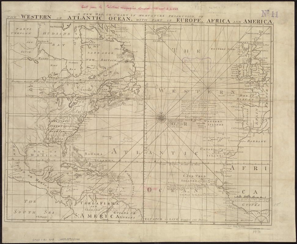
A new map or chart in Mercators projection, of the Western or Atlantic Ocean, with part of Europe, Africa and America
A new map or chart in Mercators projection, of the Western or Atlantic Ocean, with part of Europe, Africa and America
×
Item Information
Title:
A new map or chart in Mercators projection, of the Western or Atlantic Ocean, with part of Europe, Africa and America
Date:
[1781]
Format:
Maps/Atlases
Location:
Boston Public Library
Norman B. Leventhal Map Center
Collection (local):
Norman B. Leventhal Map Center Collection
Subjects:
Atlantic Ocean--Maps--Early works to 1800
North Atlantic Ocean--Maps--Early works to 1800
Places:
Atlantic Ocean
Extent:
1 map ; 39 x 52 cm.
Permalink:
https://ark.digitalcommonwealth.org/ark:/50959/kk91fq703
Terms of Use:
No known copyright restrictions.
No known restrictions on use.
Publisher:
London : J. Bew
Scale:
Scale [ca. 1:18,000,000] ;
Language:
English
Notes:
Appears in The Political Magazine, v. 2, Oct. 1781, p. 568. London: J. Bew, 1781.
Includes notes.
Notes (date):
This date is inferred.
Identifier:
06_01_007220
Call #:
G9110 1781 .N49
Barcode:
39999059030161
show more...
View MODS XML
More Like This
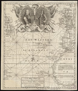
A new map or chart of the Western or Atlantic Ocean, with part of ...
Carte de la Mer du Sud et des costes d'Amerique et d'Asie situées ...
Chart of the Atlantic Ocean, with the British, French, & Spanish ...
Chart of the Atlantic Ocean, with the British, French, & Spanish ...
Find More Like This >>
Tools
Share
Facebook
Pinterest
X
Reddit
Tumblr
Email
Copy link
Add to Folder
Questions/Comments
Cite This Item
IIIF Manifest
Downloads
Primary (full resolution, uncompressed)
(TIF, 221 MB)
Large (full resolution)
(JPEG, 18.6 MB)
Medium
(JPEG, 301 KB)