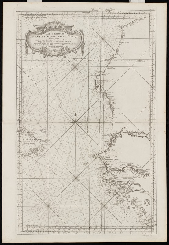
Carte réduite des costes occidentale d'Afrique : seconde feuille, depuis le Cap Bojador jusqu' a la Riviere de Sierra Leona, pour le service des Vaisseaux du Roy
Carte réduite des costes occidentale dAfrique
Item Information
Title:
Carte réduite des costes occidentale d'Afrique : seconde feuille, depuis le Cap Bojador jusqu' a la Riviere de Sierra Leona, pour le service des Vaisseaux du Roy
Description:
This chart predates the standardization of the measurement of longitude from the Greenwich Meridian, located near London. During the 18th century, map makers could choose one of several points from which to measure longitude. In fact, this chart provides references to five meridians: Paris, London (Greenwich), Ferro (western most of the Canary Islands), Tenerife (largest of The Canary Islands), and Cape Lizard (a southwestern peninsula of England). Prepared in the portolan-style, this chart contrasts nicely with modern navigational charts of the same region. They both have the same function -- to safely guide sailors through complicated and sometimes treacherous coastal waters.
First published in 1758.
Relief shown pictorially.
Depths shown by soundings.
Exhibited in “Faces and Places,” at the Boston Public Library, Boston, MA, October 2003 - September 2004. MB (BRL)