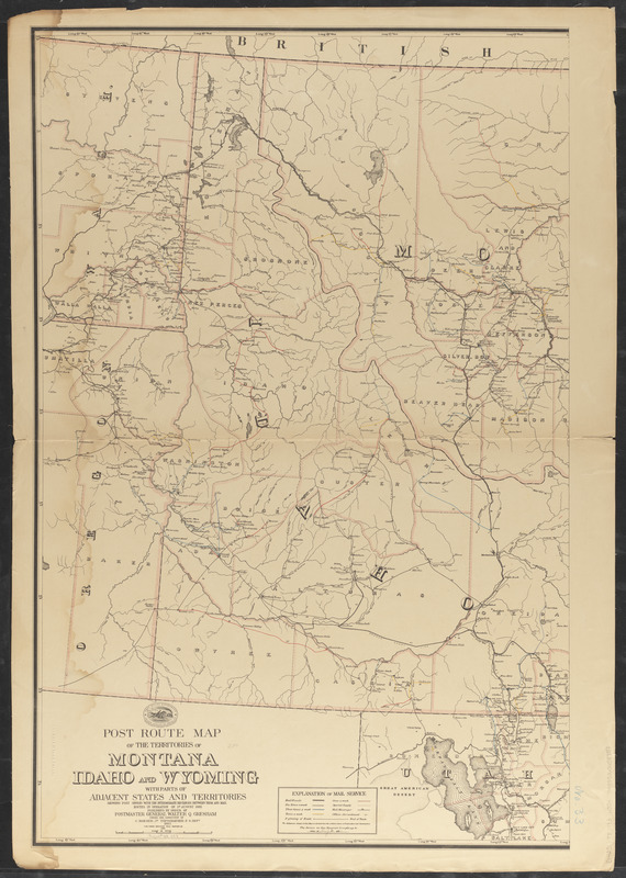
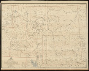
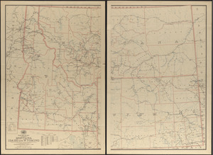
Post route map of the territories of Montana, Idaho, and Wyoming with parts of adjacent states and territories showing post offices with intermediate distances between them and mail routes in operation on 1st August 1883
Post route map of the territories of Montana, Idaho, and Wyoming with parts of adjacent states and territories showing post offices with intermediate distances between them and mail routes in operation on 1st August 1883
Post route map of the territories of Montana, Idaho, and Wyoming with parts of adjacent states and territories showing post offices with intermediate distances between them and mail routes in operation on 1st August 1883
Also shows counties, railroads, postal route beginnings and ends, frequency of mail service on each route, drainage, etc.
Prime meridian: Washington.
"The first edition was issued in 1882."
"The service on this diagram brought up to date of Aug 1st 1883."