Skip to search
Skip to main content
Digital Commonwealth
Sign Up / Log In
Search for
Search
Search
Search
Basic
Advanced
Explore
Map
Collections
Institutions
Formats
For Educators
Primary Source Sets
Lesson Plans
Using Primary Sources
Searching Digital Commonwealth
For Institutions
Join Digital Commonwealth
Conferences, Trainings, & Events
How to Contribute Collections
Digitization Services
Board & Committees
Frequently Asked Questions
About
About Digital Commonwealth
News & Announcements
Copyright & Terms of Use
Harmful Content Statement
Partners
API
Contact Us
Boston Public Library
Norman B. Leventhal Map Center Collection
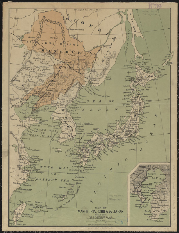
Map of Manchuria, Corea & Japan
Map of Manchuria, Corea & Japan
×
Item Information
Title:
Map of Manchuria, Corea & Japan
Title (alt.):
Map of Manchuria, Corea and Japan
Publisher:
Geo. H. Walker & Co.
Date:
(c) 1904
Format:
Maps/Atlases
Location:
Boston Public Library
Norman B. Leventhal Map Center
Collection (local):
Norman B. Leventhal Map Center Collection
Subjects:
Manchuria (China)--Maps
Korea--Maps
Japan--Maps
Places:
Manchuria
(area)
North Korea
South Korea
Japan
Extent:
1 map : color ; 54 x 40 cm
Permalink:
https://ark.digitalcommonwealth.org/ark:/50959/ht250b713
Terms of Use:
No known copyright restrictions.
No known restrictions on use.
Publisher:
Boston : Geo. H. Walker
Scale:
Scale approximately 1:6,600,000
Language:
English
Notes:
Relief shown by hachures.
Inset: Bay of Tokio.
Identifier:
06_01_015241
Call #:
G7822.M2 1904 .G46
Barcode:
39999085933842
show more...
View MODS XML
More Like This
Die aufnahmen der Engländer, Franzosen und Russen in hinter-Asien ...
Map of Korea
Map of Korea and Manchuria
Standard Russo-Japanese war map July 1904
Find More Like This >>
Tools
Share
Facebook
Pinterest
X
Reddit
Tumblr
Email
Copy link
Add to Folder
Questions/Comments
Cite This Item
IIIF Manifest
Downloads
Primary (full resolution, uncompressed)
(TIF, 86 MB)
Large (full resolution)
(JPEG, 7.22 MB)
Medium
(JPEG, 229 KB)