Skip to search
Skip to main content
Digital Commonwealth
Sign Up / Log In
Search for
Search
Search
Search
Basic
Advanced
Explore
Map
Collections
Institutions
Formats
For Educators
Primary Source Sets
Lesson Plans
Using Primary Sources
Searching Digital Commonwealth
For Institutions
Join Digital Commonwealth
Conferences, Trainings, & Events
How to Contribute Collections
Digitization Services
Board & Committees
Frequently Asked Questions
About
About Digital Commonwealth
News & Announcements
Copyright & Terms of Use
Harmful Content Statement
Partners
API
Contact Us
Boston Public Library
Norman B. Leventhal Map Center Collection
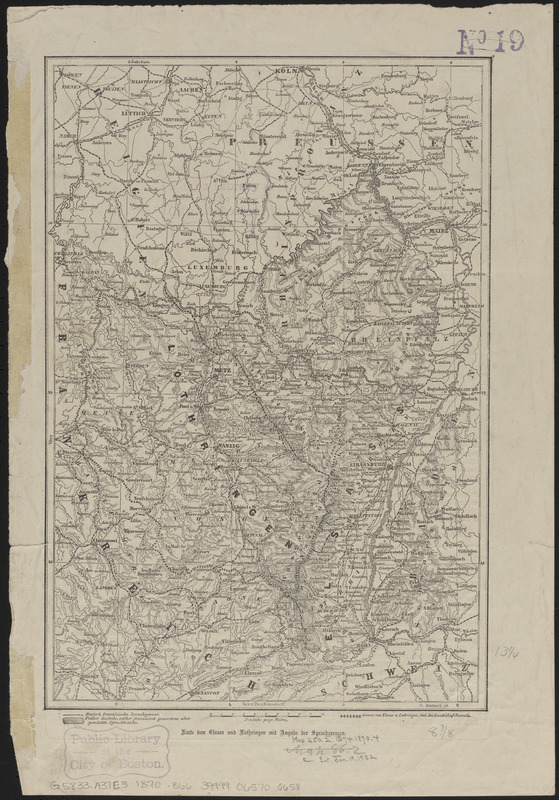
Karte von Elsass und Lothringen mit angabe der sprachgrenzen
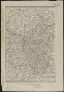
Viewing image 1 of 2
Next >
Karte von Elsass und Lothringen mit angabe der sprachgrenzen
×
Next
Item Information
Title:
Karte von Elsass und Lothringen mit angabe der sprachgrenzen
Cartographer:
Bomsdorff, Theodor von
Printer:
F.A. Brockhaus Verlag Leipzig
Name on Item:
gez. v. Th. v. Bomsdorff
Date:
1870
Format:
Maps/Atlases
Location:
Boston Public Library
Norman B. Leventhal Map Center
Collection (local):
Norman B. Leventhal Map Center Collection
Subjects:
German language--France--Alsace--Maps
French language--France--Alsace--Maps
German language--France--Lorraine--Maps
French language--France--Lorraine--Maps
Alsace (France)--Maps
Lorraine (France)--Maps
Places:
France
>
Lorraine
(former administrative division)
Extent:
1 map ; 34 x 23 cm
Permalink:
https://ark.digitalcommonwealth.org/ark:/50959/ht2506123
Terms of Use:
No known copyright restrictions.
No known restrictions on use.
Publisher:
Leipzig : J.J. Weber
Scale:
Scale approximately 1:1,250,000
Language:
German
Notes:
Relief shown by hachures.
Prime meridian: Paris.
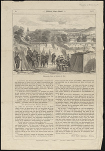
From Illustrirte kriegs chronik. Leipzig : Verlag von J.J. Weber, 1870.
Text and illustration on verso.
At top of verso: 48 -- Illustrirte kriegs chronik -- 1870.
Identifier:
06_01_014166
06_01_016593
Call #:
G5833.A37E3 1870 .B66
Barcode:
39999065700658
show more...
View MODS XML
More Like This
Alsace
Lorraine
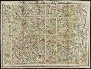
Carte Taride - routière no. 6 - Lorraine, Vosges
The 100th anniversary map of Abraham Lincoln's visit to ...
Find More Like This >>
Tools
Share
Facebook
Pinterest
X
Reddit
Tumblr
Email
Copy link
Add to Folder
Questions/Comments
Cite This Item
IIIF Manifest
Downloads
Primary (full resolution, uncompressed)
(TIF, multi-file ZIP, 223 MB)
Large (full resolution)
(JPEG, multi-file ZIP, 1010 KB)
Medium
(JPEG, multi-file ZIP, 380 KB)