Skip to search
Skip to main content
Digital Commonwealth
Sign Up / Log In
Search for
Search
Search
Search
Basic
Advanced
Explore
Map
Collections
Institutions
Formats
For Educators
Primary Source Sets
Lesson Plans
Using Primary Sources
Searching Digital Commonwealth
For Institutions
Join Digital Commonwealth
Conferences, Trainings, & Events
How to Contribute Collections
Digitization Services
Board & Committees
Frequently Asked Questions
About
About Digital Commonwealth
News & Announcements
Copyright & Terms of Use
Harmful Content Statement
Partners
API
Contact Us
Boston Public Library
Norman B. Leventhal Map Center Collection
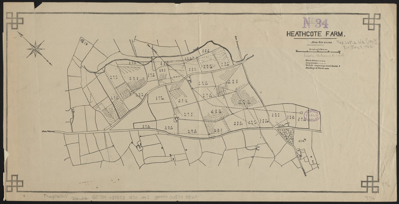
Heathcote Farm
Heathcote Farm
×
Item Information
Title:
Heathcote Farm
Date:
[1870?–1879?]
Format:
Maps/Atlases
Location:
Boston Public Library
Norman B. Leventhal Map Center
Collection (local):
Norman B. Leventhal Map Center Collection
Subjects:
Drainage--England--Heathcote--Maps
Heathcote (England)--Maps
Drainage--England--Warwick--Maps
Warwick (England)--Maps
Places:
England
>
Warwickshire (county)
>
Warwick
Extent:
1 map ; 22 x 45 cm
Permalink:
https://ark.digitalcommonwealth.org/ark:/50959/ht250503x
Terms of Use:
No known copyright restrictions.
No known restrictions on use.
Publisher:
[Place of publication not identified] : [publisher not identified]
Scale:
Scale approximately 1:8,800
Language:
English
Notes:
Shows main sewer, deep drains and wells for inspecting small drains.
Oriented with north to the upper left.
Identifier:
06_01_014920
Call #:
G5754.H335C3 1870 .H43
Barcode:
39999065708560
show more...
View MODS XML
More Like This
The 100th anniversary map of Abraham Lincoln's visit to ...
1630 shoreline
1879. Progress map of the U.S. Geographical Surveys west of the ...
1903 Map of Salem and surrounding places
Find More Like This >>
Tools
Share
Facebook
Pinterest
X
Reddit
Tumblr
Email
Copy link
Add to Folder
Questions/Comments
Cite This Item
IIIF Manifest
Downloads
Primary (full resolution, uncompressed)
(TIF, 50.1 MB)
Large (full resolution)
(JPEG, 4.21 MB)
Medium
(JPEG, 356 KB)