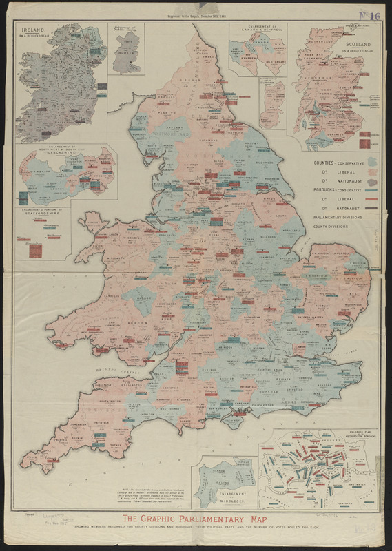
The Graphic parliamentary map showing members returned for county divisions and boroughs : their political party, and the number of votes polled for each
The Graphic parliamentary map showing members returned for county divisions and boroughs
Item Information
Title:
The Graphic parliamentary map showing members returned for county divisions and boroughs : their political party, and the number of votes polled for each
Insets: Ireland on a reduced scale -- Enlargement of Dublin County -- Enlargement of south west and south east Lancashire -- Enlargement of a portion of Staffordshire -- Enlargement of Lanark & Renfrew -- Enlargement of part of Durham -- Scotland on a reduced scale -- Enlargement of Middlesex -- Enlarged plan of the metropolitan boroughs.
"Supplement to the Graphic, December 26th, 1885."