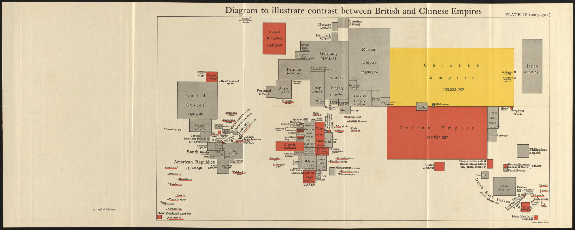
Cartogram showing country sizes based on population.
Areas under the dominion of the British Empire indicated in red.
Appears in The commonwealth of nations / edited by L. Curtis.
"Plate IV (see page I)."
"At end of volume."
Notes (exhibitions):
Exhibited: "Bending lines: maps and data from distortion to deception," organized by the Norman B. Leventhal Map & Education Center at the Boston Public Library, 2020-2021.