Skip to search
Skip to main content
Digital Commonwealth
Sign Up / Log In
Search for
Search
Search
Search
Basic
Advanced
Explore
Map
Collections
Institutions
Formats
For Educators
Primary Source Sets
Lesson Plans
Using Primary Sources
Searching Digital Commonwealth
For Institutions
Join Digital Commonwealth
Conferences, Trainings, & Events
How to Contribute Collections
Digitization Services
Board & Committees
Frequently Asked Questions
About
About Digital Commonwealth
News & Announcements
Copyright & Terms of Use
Harmful Content Statement
Partners
API
Contact Us
Boston Public Library
Norman B. Leventhal Map Center Collection
/
Maritime Charts and Atlases (Collection of Distinction)
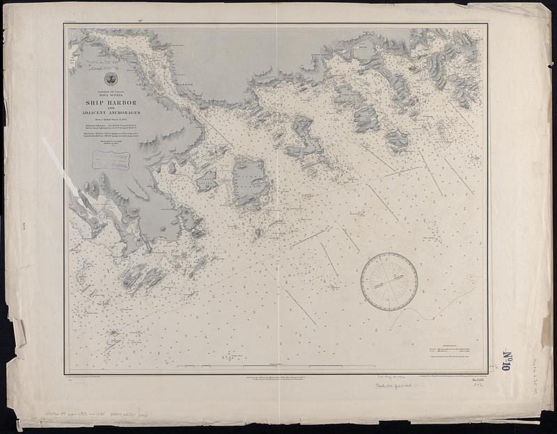
Dominion of Canada, Nova Scotia, Ship Harbor and adjacent anchorages : from a British survey in 1854
Dominion of Canada, Nova Scotia, Ship Harbor and adjacent anchorages
×
Item Information
Title:
Dominion of Canada, Nova Scotia, Ship Harbor and adjacent anchorages : from a British survey in 1854
Issuing body:
United States. Hydrographic Office
Engraver:
Dougal, W. M. (William M.)
Engraver:
Franke, M. (Max)
Draftsman:
Klakring, A. (Alfred)
Engraver:
Ruebsam, E. A. (E. August)
Draftsman:
Wimpffen, L. F. von (Lebreclit Felix von)
Name on Item:
drawn by L.F. von Wimpffen amd A. Klakring ; engraved by W.M. Dougal, M. Franke and E.A. Ruebsam
Date:
1889
Format:
Maps/Atlases
Genre:
Nautical charts
Location:
Boston Public Library
Norman B. Leventhal Map Center
Collection (local):
Norman B. Leventhal Map Center Collection
Subjects:
Ship Harbour (N.S. : Harbor)--Maps
Coasts--Nova Scotia--Maps
Navigation--Nova Scotia--Ship Harbour (Harbor)
Places:
Canada
>
Nova Scotia
(province)
Ship Harbour
Extent:
1 map ; 52 x 62 cm
Permalink:
https://ark.digitalcommonwealth.org/ark:/50959/db78x259p
Terms of Use:
No known copyright restrictions.
No known restrictions on use.
Publisher:
[Washington, D.C.] : Hydrographic Office
Scale:
Scale approximately 1:37,500
Language:
English
Notes:
Relief shown by shading and spot heights. Depths shown by soundings and isolines.
Identifier:
06_01_017037
Call #:
G9096.P5 svar .U55
Barcode:
39999085953998
show more...
View MODS XML
More Like This
A chart of the North-American coast, for the navigation between ...
Dominion of Canada, Nova Scotia, Whitehaven : from a British ...
North America, Dominion of Canada, Gulf of St. Lawrence, Prince ...
S.e. coast of Nova Scotia : from the most recent British surveys
Find More Like This >>
Tools
Share
Facebook
Pinterest
X
Reddit
Tumblr
Email
Copy link
Add to Folder
Questions/Comments
Cite This Item
IIIF Manifest
Downloads
Primary (full resolution, uncompressed)
(TIF, 118 MB)
Large (full resolution)
(JPEG, 9.92 MB)
Medium
(JPEG, 87.6 KB)