Maury's Wind and Current Chart
Item Information
- Title:
- Maury's Wind and Current Chart
- Description:
-
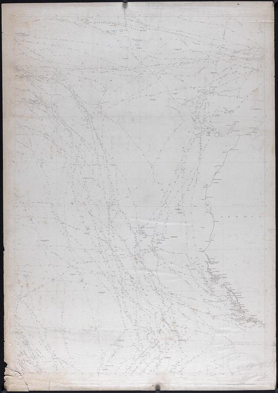
Untitled sheet from the 1st or 2nd edition of Maury's Wind and Current Chart. Includes the courses of several US Navy ships in the Atlantic Ocean, near the North Western coast of Africa, including Cape Verde, the Canary Islands, and the Azores. Each route is dated and markings along each note the direction of the wind. Ships shown are: The Peacock, Constellation, Constitution, Potomac, Brandywine, Lexington, Fairfield, Guerriere, Vincennes, Independence, Congress, United States, St. Louis, Cyane, Ontario, and John Adams.
- Creator:
- Maury, Matthew Fontaine, 1806-1873
- Date:
-
[1845–1850]
- Format:
-
Maps/Atlases
- Genre:
-
Nautical charts
- Location:
-
New Bedford Free Public Library
Art Room. Cabinet: MC04, Drawer: DR10 (shelf locator) - Collection (local):
-
Map and Chart Collection
- Subjects:
-
Winds
- Places:
-
West Africa (area)
Atlantic Ocean
- Extent:
- 1 map ; 37 x 26 in.
- Permalink:
- https://ark.digitalcommonwealth.org/ark:/50959/d504v824v
- Terms of Use:
-
Rights status not evaluated
This work is licensed for use under a Creative Commons Attribution Non-Commercial No Derivatives License (CC BY-NC-ND).