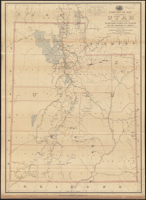
Post route map of the territory of Utah with adjacent parts of the states of Nevada, Idaho, Wyoming and Colorado and the territory of Arizona : showing post offices with the intermediate distances and mail routes in operation on the 1st of October 1891
Post route map of the territory of Utah with adjacent parts of the states of Nevada, Idaho, Wyoming and Colorado and the territory of Arizona
Item Information
Title:
Post route map of the territory of Utah with adjacent parts of the states of Nevada, Idaho, Wyoming and Colorado and the territory of Arizona : showing post offices with the intermediate distances and mail routes in operation on the 1st of October 1891
Shows county boundaries, railroads, and post routes reflecting frequency of delivery.
Prime meridians: Washington, D.C. and Greenwich.
Relief shown by hachures.
"The service on this diagram brought up to date of October 1st. 1891."